The Coordinate Plane
Not sure you’re ready?
Take the ~3-minute readiness diagnostic and see where you stand.
Imagine an entirely blank sheet of paper spanning infinitely in all directions. To pinpoint a single, unique location on this boundless surface, you need a precise system of reference. In the seventeenth century, mathematician René Descartes conceptualized a solution that would forever unify geometry and algebra: the coordinate plane. At its core, the coordinate plane is a two-dimensional surface formed by two intersecting perpendicular number lines. This framework transforms an abstract void into a highly organized grid, allowing us to translate physical spaces, geometric shapes, and algebraic relationships into rigorous mathematical language.

To understand the coordinate plane, we must first understand the scaffolding that holds it together. The entire system is built upon two infinitely long, perpendicular number lines that lock together to form a crosshair.
The horizontal number line in a coordinate plane is named the x-axis. Like a standard number line, it stretches infinitely to the left and the right. The vertical number line in a coordinate plane is named the y-axis, stretching infinitely up and down.
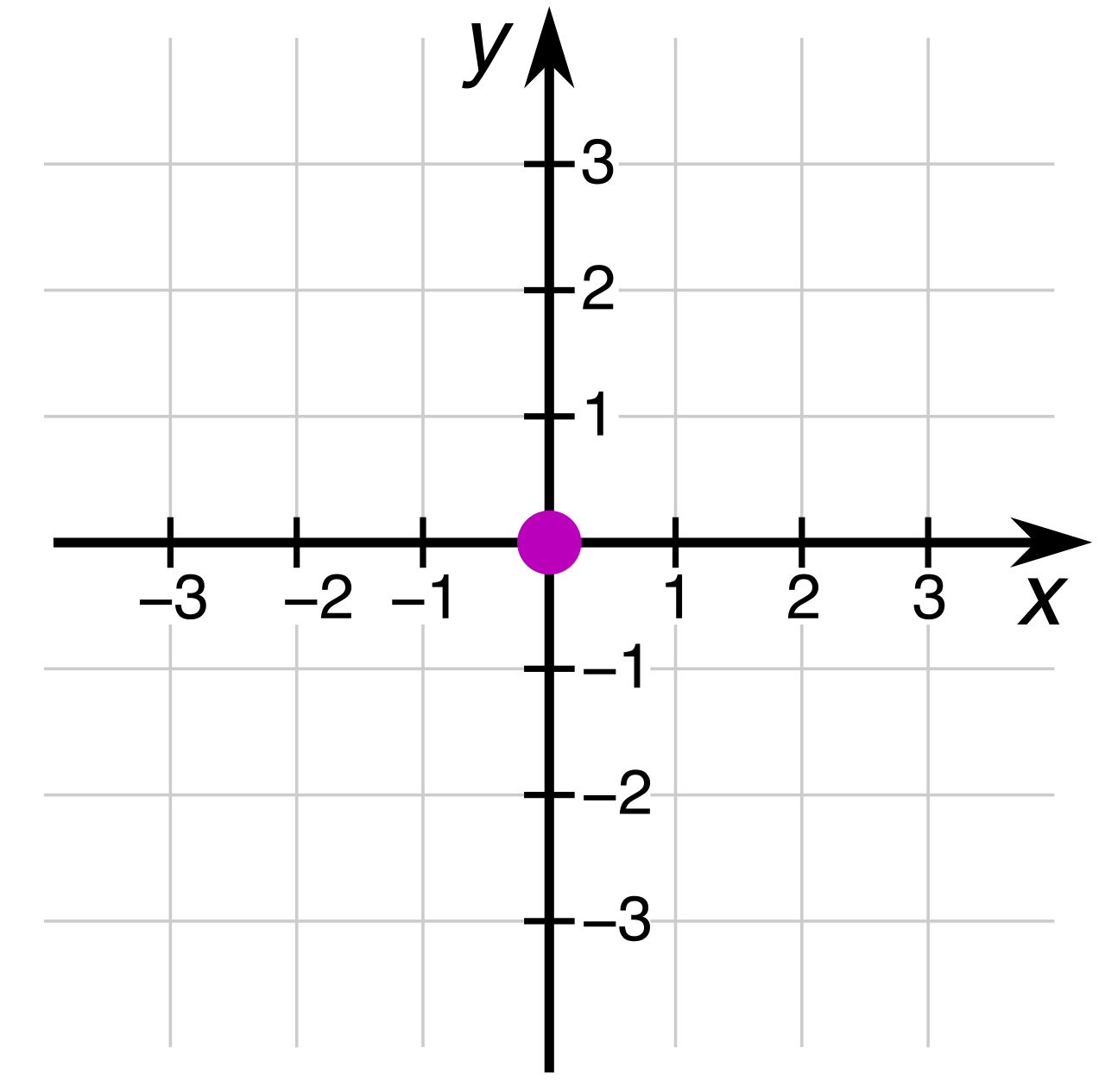
These two lines meet at a solitary, fundamental location: the origin. The exact point of intersection between the x-axis and the y-axis is called the origin, and it serves as the absolute zero-point for all navigation on the plane. Because it sits perfectly in the center, neither shifting left nor right, the x-coordinate of the origin is strictly zero. Because it neither shifts up nor down, the y-coordinate of the origin is strictly zero.
The Origin The mathematical anchor of the coordinate plane. Its coordinates are always exactly (0,0).
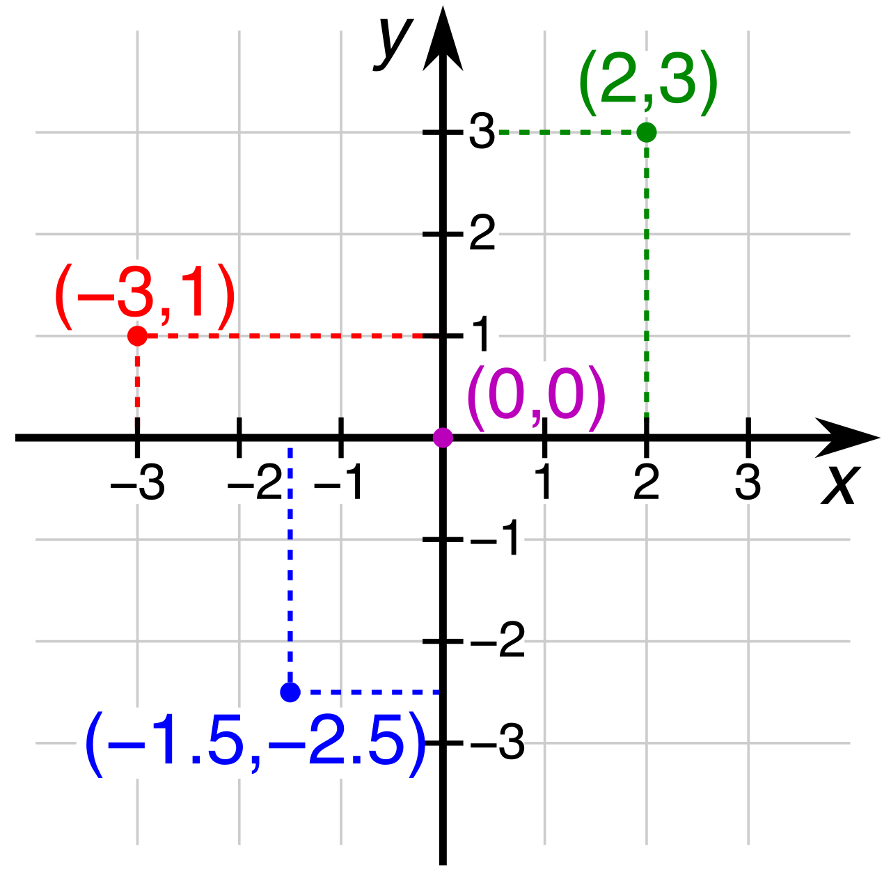
To communicate a specific location on the coordinate plane, we use a pairing of numbers. An ordered pair consists of two numbers used to define the exact location of a point on a coordinate plane. The word ordered is paramount—the sequence of the numbers changes the meaning entirely.
The first number in an ordered pair represents the x-coordinate. The horizontal position of a point on the coordinate plane is determined exclusively by the x-coordinate. When analyzing this first number, it is crucial to realize that the x-coordinate indicates the horizontal distance of a point from the y-axis.
- A positive x-coordinate dictates movement to the right of the y-axis.
- A negative x-coordinate dictates movement to the left of the y-axis.
The second number in an ordered pair represents the y-coordinate. The vertical position of a point on the coordinate plane is determined exclusively by the y-coordinate. Consequently, the y-coordinate indicates the vertical distance of a point from the x-axis.
- A positive y-coordinate dictates upward movement from the x-axis.
- A negative y-coordinate dictates downward movement from the x-axis.
If you are plotting the ordered pair (4,−3), you are receiving two strict, independent commands: First, move 4 units to the right of the y-axis. Second, move 3 units downward from the x-axis.
Because the x-axis and y-axis intersect indefinitely, they slice the infinite two-dimensional space into four distinct regions. The x-axis and y-axis divide the coordinate plane into four distinct regions called quadrants.
By mathematical convention, the four quadrants of a coordinate plane are traditionally numbered using Roman numerals (I, II, III, IV). We do not read them left-to-right like a book. Instead, the quadrants are numbered sequentially in a counterclockwise direction starting from the upper-right quadrant.
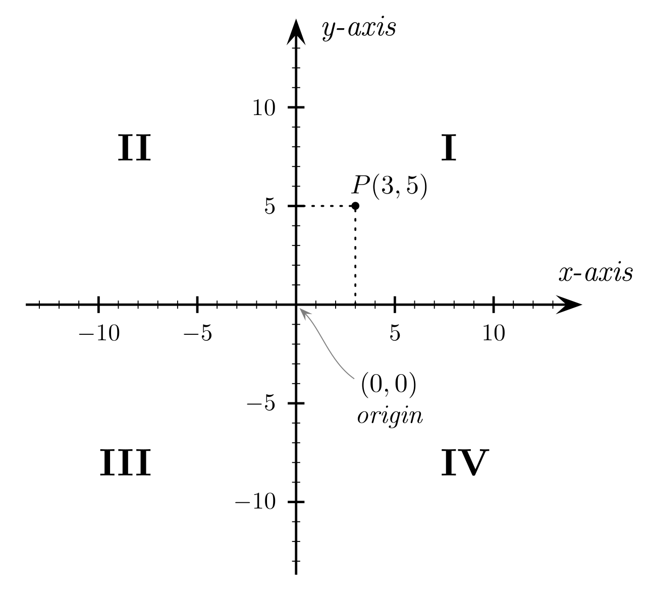
Let us map out the distinct mathematical identities of these four regions.
Quadrant I
Quadrant I is the upper-right region of the coordinate plane. Because navigating to this region requires moving right and up, every point located in Quadrant I has a positive x-coordinate, and every point located in Quadrant I has a positive y-coordinate.
Quadrant II
Continuing counterclockwise, Quadrant II is the upper-left region of the coordinate plane. To arrive here, we must travel left along the horizontal, but still up along the vertical. Thus, every point located in Quadrant II has a negative x-coordinate, while every point located in Quadrant II has a positive y-coordinate.
Quadrant III
Directly below Quadrant II, Quadrant III is the lower-left region of the coordinate plane. Navigation requires moving left and down. Every point located in Quadrant III has a negative x-coordinate, and every point located in Quadrant III has a negative y-coordinate.
Quadrant IV
Finally, Quadrant IV is the lower-right region of the coordinate plane. We travel right, then down. Therefore, every point located in Quadrant IV has a positive x-coordinate, and every point located in Quadrant IV has a negative y-coordinate.
| Quadrant | Position | x-coordinate | y-coordinate | Ordered Pair Format |
|---|---|---|---|---|
| I | Upper-Right | Positive | Positive | (+,+) |
| II | Upper-Left | Negative | Positive | (−,+) |
| III | Lower-Left | Negative | Negative | (−,−) |
| IV | Lower-Right | Positive | Negative | (+,−) |
The In-Between Spaces: Points on the Axes
A common conceptual trap is trying to assign a quadrant to every single point on the plane. What happens when a coordinate is exactly zero?
If we have the point (5,0), we travel 5 units right, but we do not travel vertically at all. We are marooned on the x-axis. Mathematically, any point positioned exactly on the x-axis has a y-coordinate equal to zero. Conversely, if we have the point (0,−7), we do not travel horizontally at all; we simply drop 7 units down the vertical line. Any point positioned exactly on the y-axis has an x-coordinate equal to zero.
Crucial Axis Rule Points residing on either the x-axis or the y-axis do not belong to any of the four quadrants. They are the borders defining the regions, not the regions themselves.
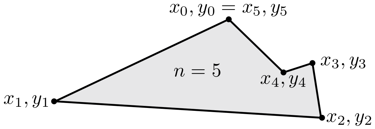
The true power of the coordinate plane reveals itself when we transition from single, isolated points to connected structures. A polygon is constructed on a coordinate plane by plotting individual vertices as ordered pairs. Once the distinct corners of our shape are anchored to the grid, the plotted vertices of a polygon must be connected with straight line segments to form a closed geometric shape.
Imagine plotting three points: (1,1), (1,5), and (4,1). By placing a point at each ordered pair and snapping straight line segments between them, a right triangle materializes from the abstract numbers. By digitizing geometry in this way, we can measure physical properties of shapes entirely through arithmetic.
To understand the scale of shapes plotted on a plane, we must be able to calculate distance. When line segments are perfectly horizontal or perfectly vertical, computing distance is elegantly simple.
Horizontal Distance
If two points lie on the same horizontal line, their vertical height is identical. To find how far apart they are, we only need to look at their horizontal positions. The distance between two points sharing the same y-coordinate equals the absolute value of the difference between the x-coordinates.
For example, to find the distance between (2,4) and (8,4), we note the y-coordinates are the same. We take the difference between the x-coordinates (2 and 8). ∣2−8∣=∣−6∣=6 units.
Vertical Distance
The same logic applies vertically. If two points lie on the same vertical line, their horizontal shift is identical. The distance between two points sharing the same x-coordinate equals the absolute value of the difference between the y-coordinates.
To find the distance between (−3,−1) and (−3,−9), we see the x-coordinates are identical. We find the difference between the y-coordinates (−1 and −9). ∣−1−(−9)∣=∣−1+9∣=∣8∣=8 units.
Calculating Perimeter and Area
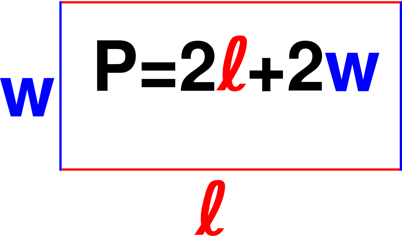
Why do these distances matter? Because they are the raw materials for geometric analysis. Coordinate plane distances between vertices are used to determine the lengths of polygon sides for calculating perimeter. If we plot a rectangle and use the absolute value formulas to find that its top side is 5 units long and its vertical side is 3 units long, we instantly know the perimeter is 5+5+3+3=16 units.
Furthermore, coordinate plane distances between vertices are used to determine the dimensions of polygons for area calculations. For that same rectangle, multiplying the calculated horizontal dimension (base) by the vertical dimension (height) yields the area: 5×3=15 square units.
By mastering the coordinate plane, you gain the ability to navigate, map, construct, and measure any two-dimensional space. The ordered pairs cease to be mere numbers; they become precise architectural blueprints for the mathematical world.