Geography and Human Systems
Not sure you’re ready?
Take the ~3-minute readiness diagnostic and see where you stand.
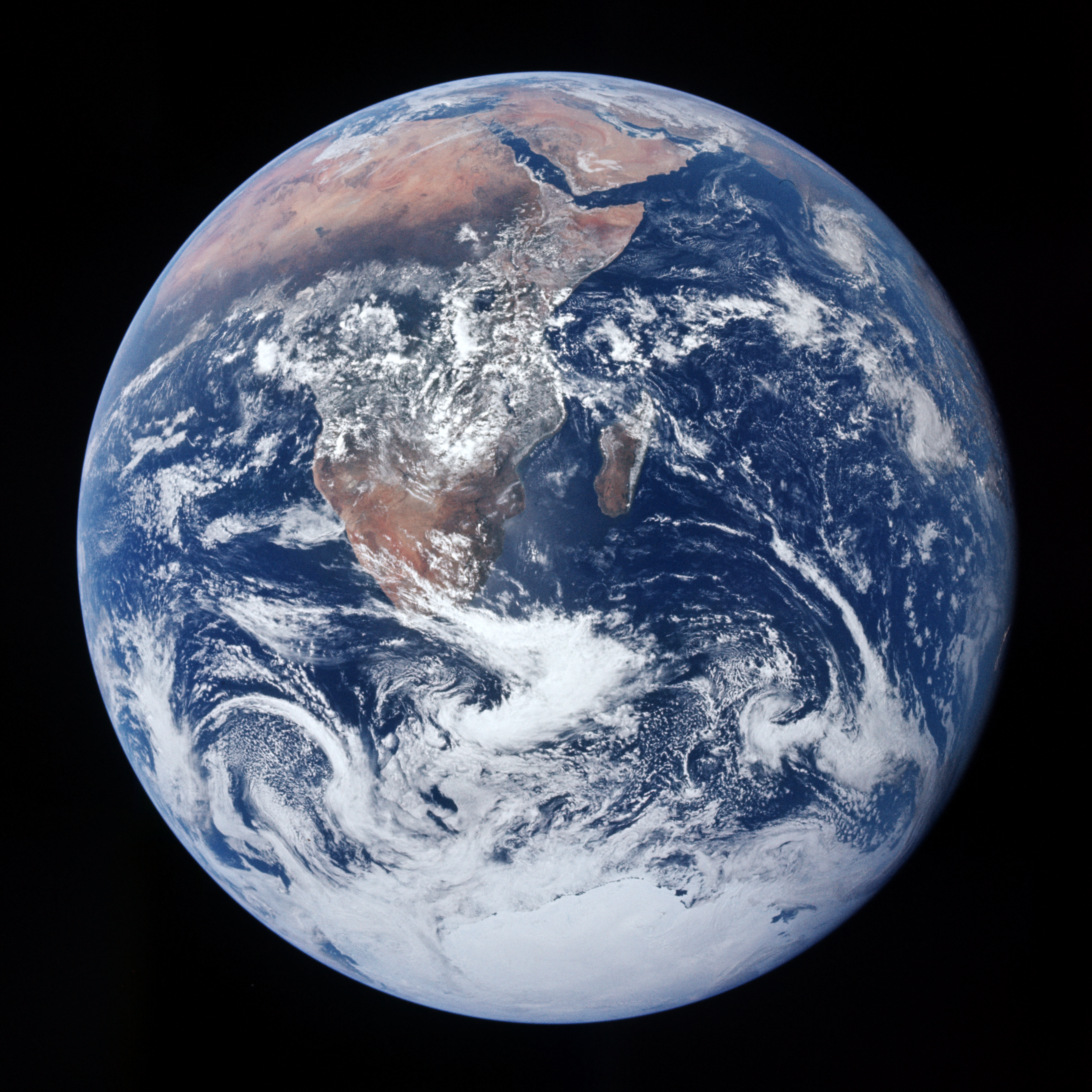
Look at a satellite image of the Earth: a swirling marble of blue oceans and green landmasses, entirely indifferent to the borders and lines we draw upon it. Yet, to navigate this immense sphere, human beings have invented an intricate, highly precise language of geography. We cast imaginary coordinate grids across the oceans, project spherical continents onto flat paper, and endlessly modify the very dirt beneath our feet to survive. Geography is not merely the rote memorization of capital cities; it is the rigorous study of space, place, and the relentless, dynamic interaction between human societies and the physical environment. To master this discipline is to understand the operating system of the planet.
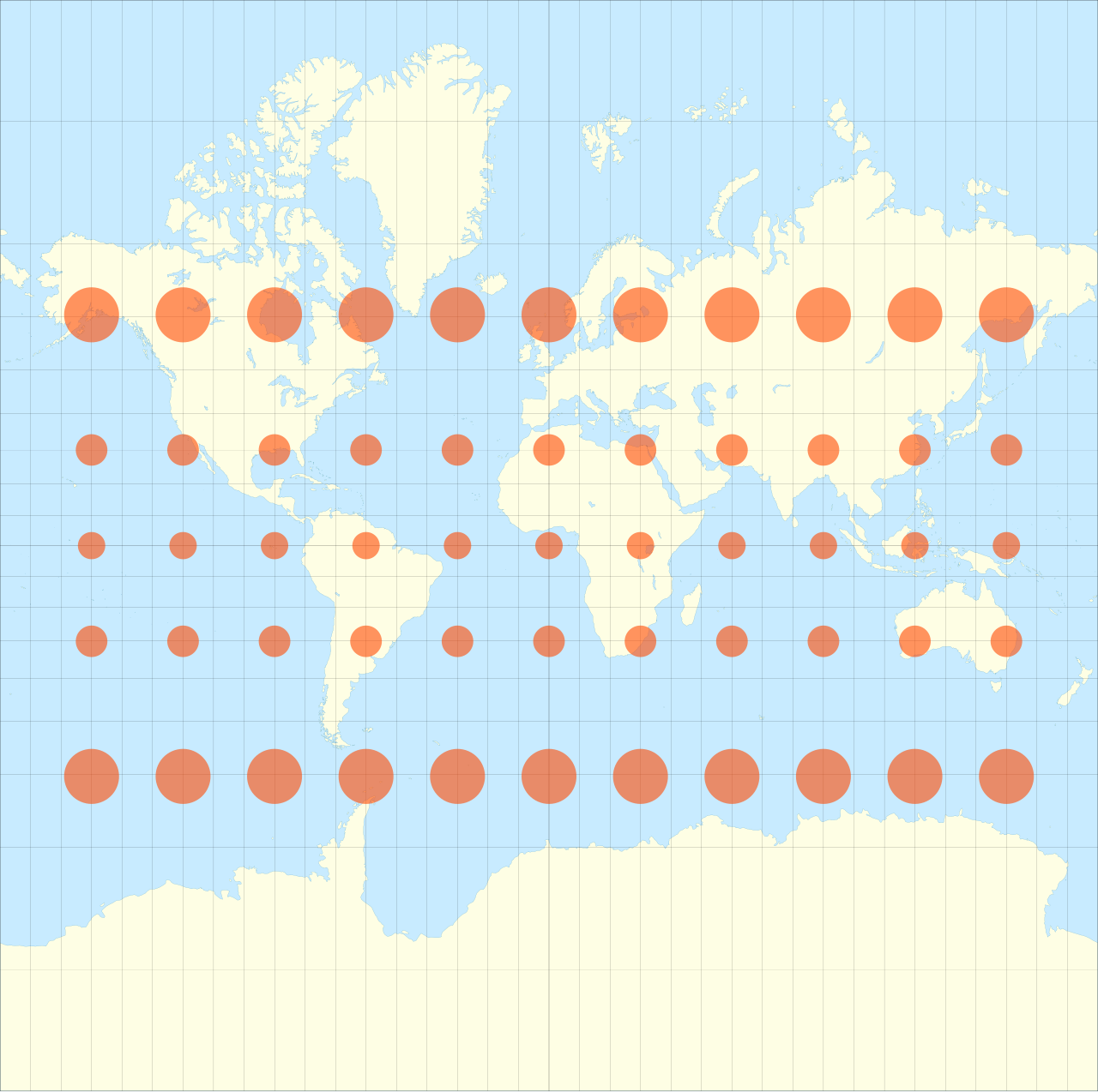
A map is a flat representation of a curved surface, which means every map is inherently a calculated distortion. Cartographers solve this problem by designing different maps to tell specific spatial truths.
To read any map, you must first understand the fundamental tools of cartography:
- A map legend explains the specific symbols, colors, and lines used on a given map. Without a legend, a blue line could be a river, a highway, or a political border.
- A map scale represents the proportional relationship between the distance on a map and the actual distance on Earth. It allows us to translate an inch of paper into a hundred miles of terrain.
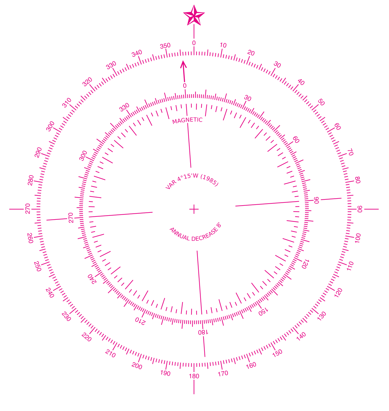
- A compass rose indicates the cardinal directions of North, South, East, and West on a map, anchoring the document to the Earth’s magnetic poles.
Once we have the tools to read the map, we must select the correct map for the problem we are trying to solve.
| Map Type | Fundamental Purpose |
|---|---|
| Political Map | A political map displays human-made boundaries, countries, states, and cities. It shows us how humanity has carved up the landmasses into sovereign territories. |
| Physical Map | A physical map displays natural features such as mountains, rivers, lakes, and elevations. It ignores political borders to show the geographic reality of the terrain. |
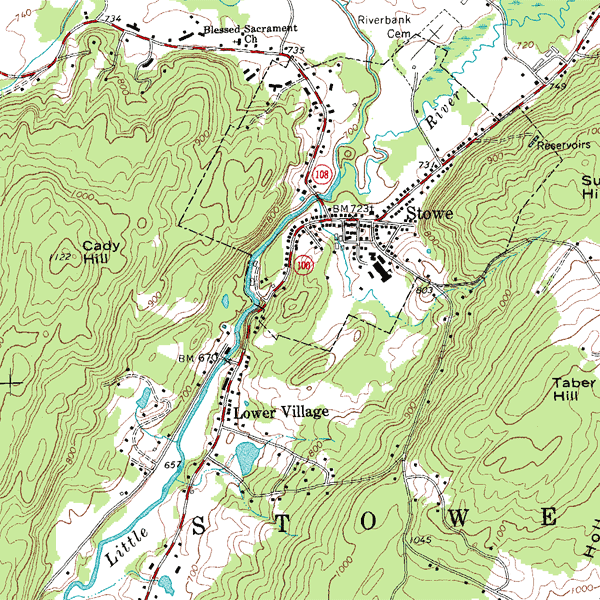
| Topographic Map | A topographic map uses contour lines to show the detailed shape and elevation of the land. Imagine slicing a mountain horizontally at regular intervals; those slices form the contour lines that let you visualize a 3D slope on a 2D piece of paper. |
| Thematic Map | A thematic map focuses on a specific topic such as population density, climate, or economic activity. Instead of navigating terrain, you use a thematic map to navigate data. |
If you are standing in a crowded city, you might tell a friend you are "three blocks past the central station." This is relative location, which describes the position of a place in relation to other nearby places or landmarks.
But what if you are in the middle of the ocean, with no landmarks in sight? Relative location fails entirely. For precise navigation, humanity invented a planetary grid system to establish absolute location, which is the exact position of a place on Earth using a coordinate system.
The Mathematics of Latitude and Longitude
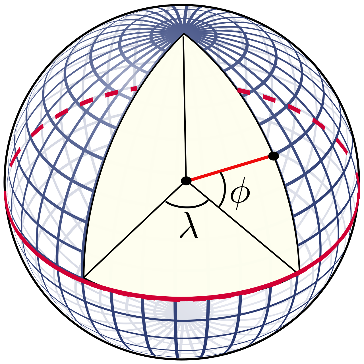
To calculate absolute location, we wrap the globe in intersecting lines.
Latitude lines run horizontally around the Earth parallel to the Equator. They measure how far north or south you are. The anchor of this system is the Equator, which is a line of latitude located at exactly zero degrees. By slicing the planet in half horizontally, the Equator divides the Earth into the Northern Hemisphere and the Southern Hemisphere.
Because the Earth is tilted on its axis relative to the sun, we have two other critical lines of latitude that dictate our global climate zones:
- The Tropic of Cancer is a line of latitude located at 23.5 degrees north of the Equator.
- The Tropic of Capricorn is a line of latitude located at 23.5 degrees south of the Equator.
Intersecting the lines of latitude are longitude lines. Longitude lines run vertically from the North Pole to the South Pole. They measure how far east or west you are. The anchor here is the Prime Meridian, which is a line of longitude located at exactly zero degrees. By slicing the planet vertically, the Prime Meridian divides the Earth into the Eastern Hemisphere and the Western Hemisphere.
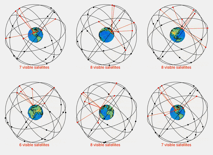
Today, we no longer need to rely solely on sextants and printed grids to find our coordinates. Modern geography is powered by high technology: the Global Positioning System relies on a network of orbital satellites to calculate the exact absolute location of a receiver on Earth by measuring the time it takes for radio signals to travel from space to your device.
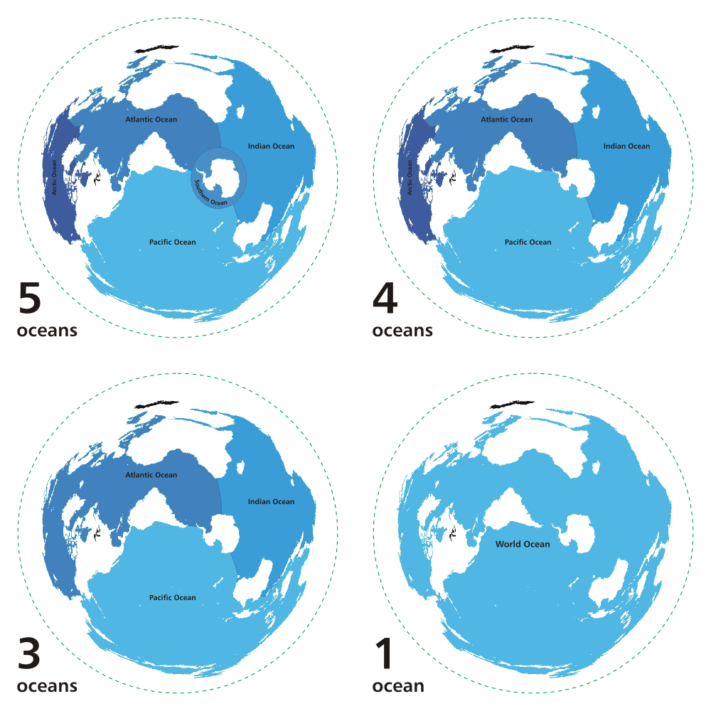
At the macro scale, the physical features of the Earth are dominated by vast expanses of land and water.
- The Earth has five major oceans consisting of the Atlantic, Pacific, Indian, Arctic, and Southern Oceans. Of these massive bodies of water, the Pacific Ocean is the largest ocean on Earth.
- Rising above the oceans, the Earth has seven continents consisting of Africa, Antarctica, Asia, Australia, Europe, North America, and South America. Spanning a massive portion of the Eastern Hemisphere, Asia is the largest continent on Earth in terms of total land area.
To make sense of these massive landmasses, geographers divide the world into manageable chunks called regions. A region is an area unified by a shared characteristic, but the nature of that characteristic determines the type of region.
Formal Region: A formal region is a geographic area defined by distinct physical or cultural characteristics. Example: The Sahara Desert (defined by an arid physical climate) or Latin America (defined by broadly shared cultural and linguistic traits).
Functional Region: A functional region is a geographic area organized around a central hub or focal point. Example: A metropolitan transit system, a local television broadcast radius, or the delivery zone of a distribution center. If the central hub shuts down, the functional region ceases to exist.
Perceptual Region: A perceptual region is a geographic area defined by the subjective feelings and attitudes of people. Example: "The American Midwest" or "The Middle East." You cannot point to an exact mathematical boundary for these regions; they exist in the collective human imagination.
Geography is not a static picture; it is an active collision between nature and civilization. Human-environment interaction describes the ways people adapt to, modify, and depend on the natural environment.
We are entirely reliant on the Earth to sustain us, but the Earth is rarely optimized for human habitation. Therefore, we must continually alter it.
Modifying the Environment
When the physical landscape refuses to cooperate with our needs, we force it to bend.
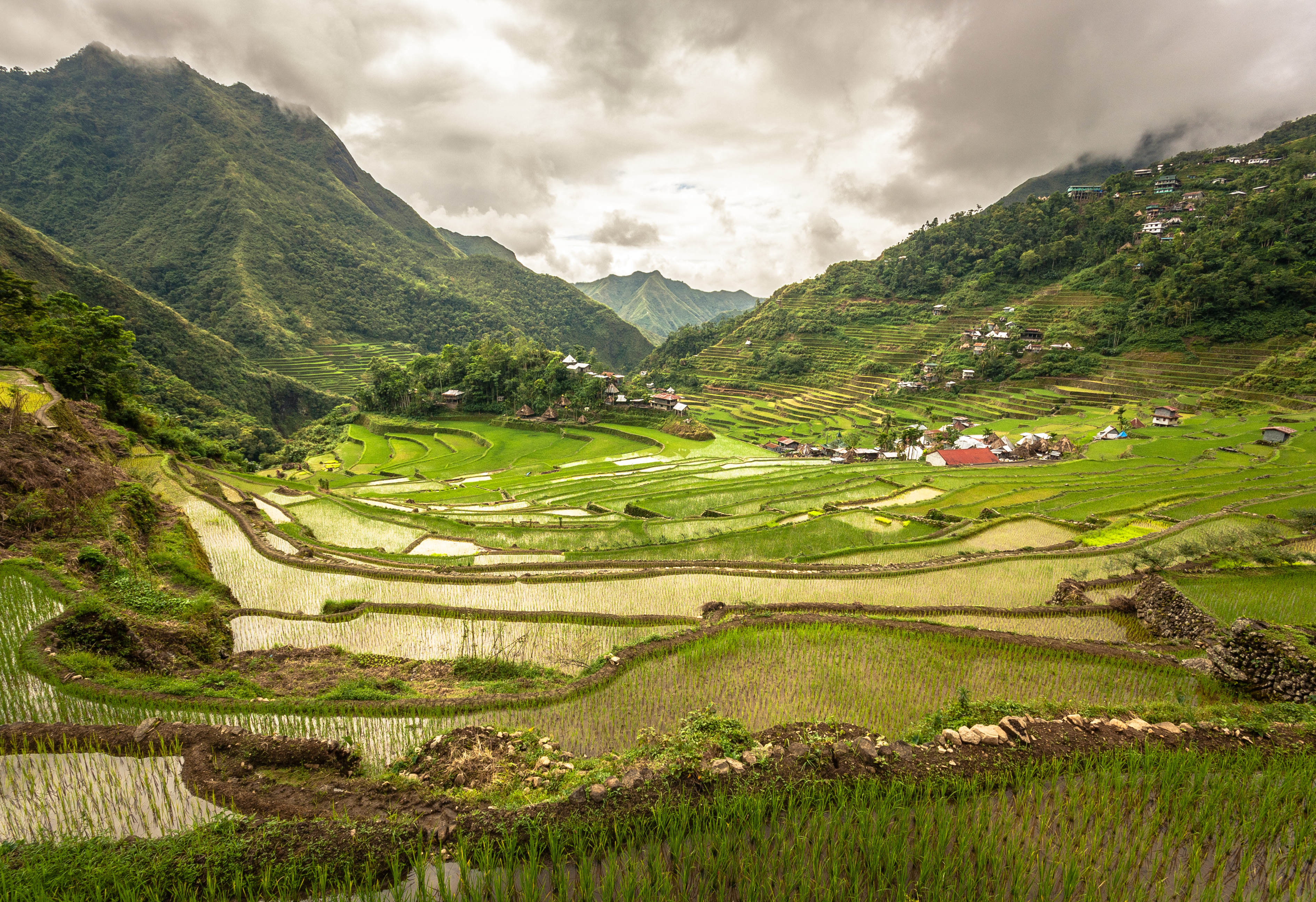
- Terrace farming is an agricultural modification where flat steps are carved into hillsides to reduce soil erosion. By cheating gravity, early societies in the Andes and the Himalayas turned sheer, unfarmable mountain slopes into highly productive agricultural land.
- Where rainfall is scarce, we alter the hydrology. Irrigation is the human-engineered application of water to dry land to assist in the production of agricultural crops.
- To master the immense kinetic energy of rivers, building dams is a human modification of the physical environment used to control flooding and generate power.
Adapting to the Environment
Sometimes, the physical environment is too powerful to modify. In these cases, humanity must adapt. For instance, in areas facing chronic water shortages, the development of drought-resistant crops is a method of human adaptation to arid climate conditions. We change our biology and our agricultural science rather than attempting to change the weather.
The Consequences of Interaction
Every modification carries an environmental price. Because we depend so heavily on physical resources, our interventions can trigger devastating feedback loops.
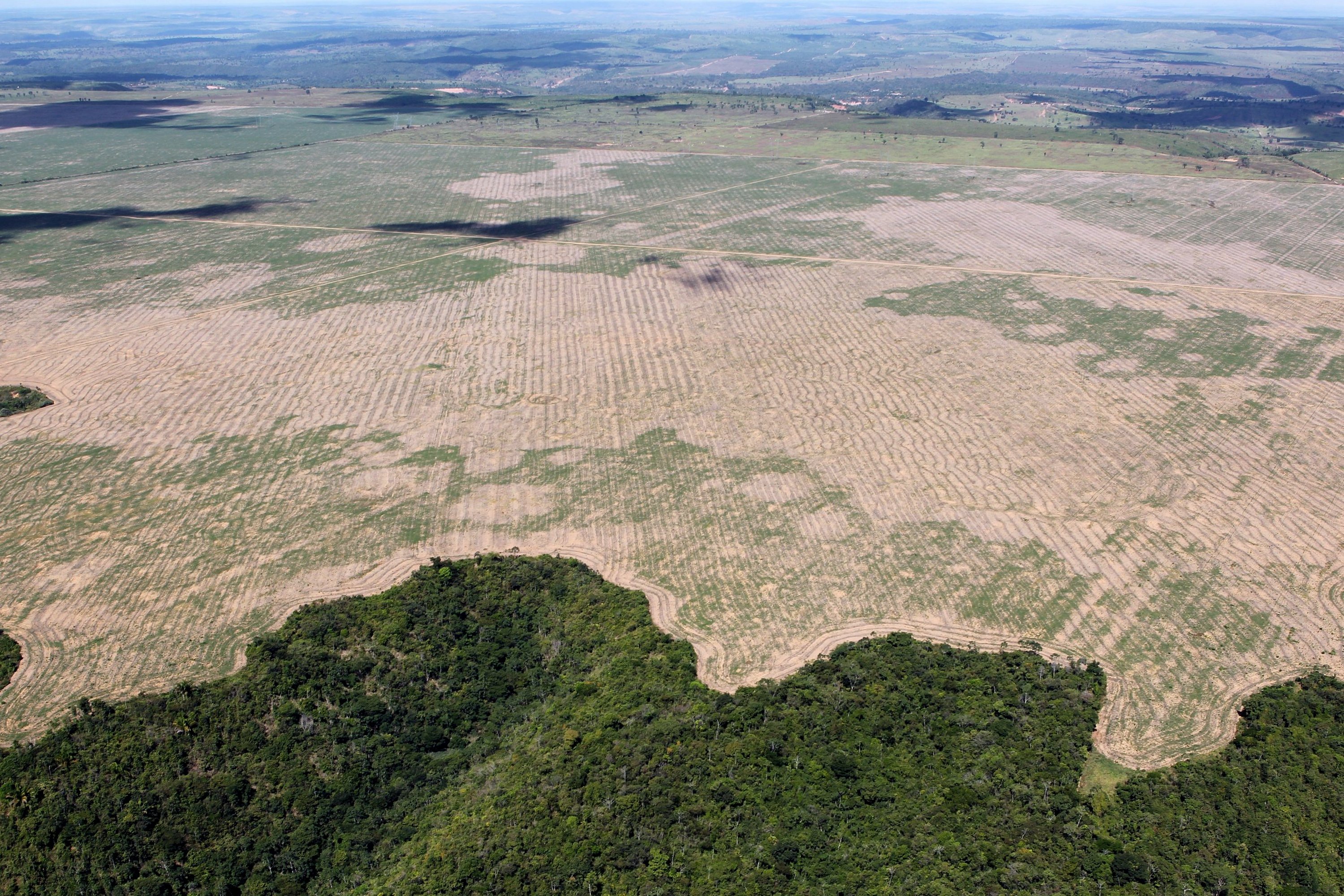
- Deforestation is the intentional clearing of forested land by humans to make space for agriculture or urban development.
- When tree roots are no longer present to anchor the soil and retain moisture, regions become highly vulnerable. Desertification is the process by which fertile land becomes desert due to human-caused deforestation or drought.
- At an atmospheric level, the burning of fossil fuels alters the physical environment by increasing the concentration of greenhouse gases in the atmosphere, trapping solar radiation and driving global climate shifts.
Movement, Migration, and Diffusion
The physical environment dictates where humans live, and changes to that environment drive massive shifts in human populations.
When the environment collapses, people are forced into motion. Natural disasters such as prolonged droughts frequently compel large human populations to migrate to new regions. Conversely, economic opportunities pull populations toward the wilderness. The extraction of natural resources often leads to the rapid growth of new human settlements in previously unpopulated regions—think of the mid-19th-century California Gold Rush or modern oil boomtowns in North Dakota.
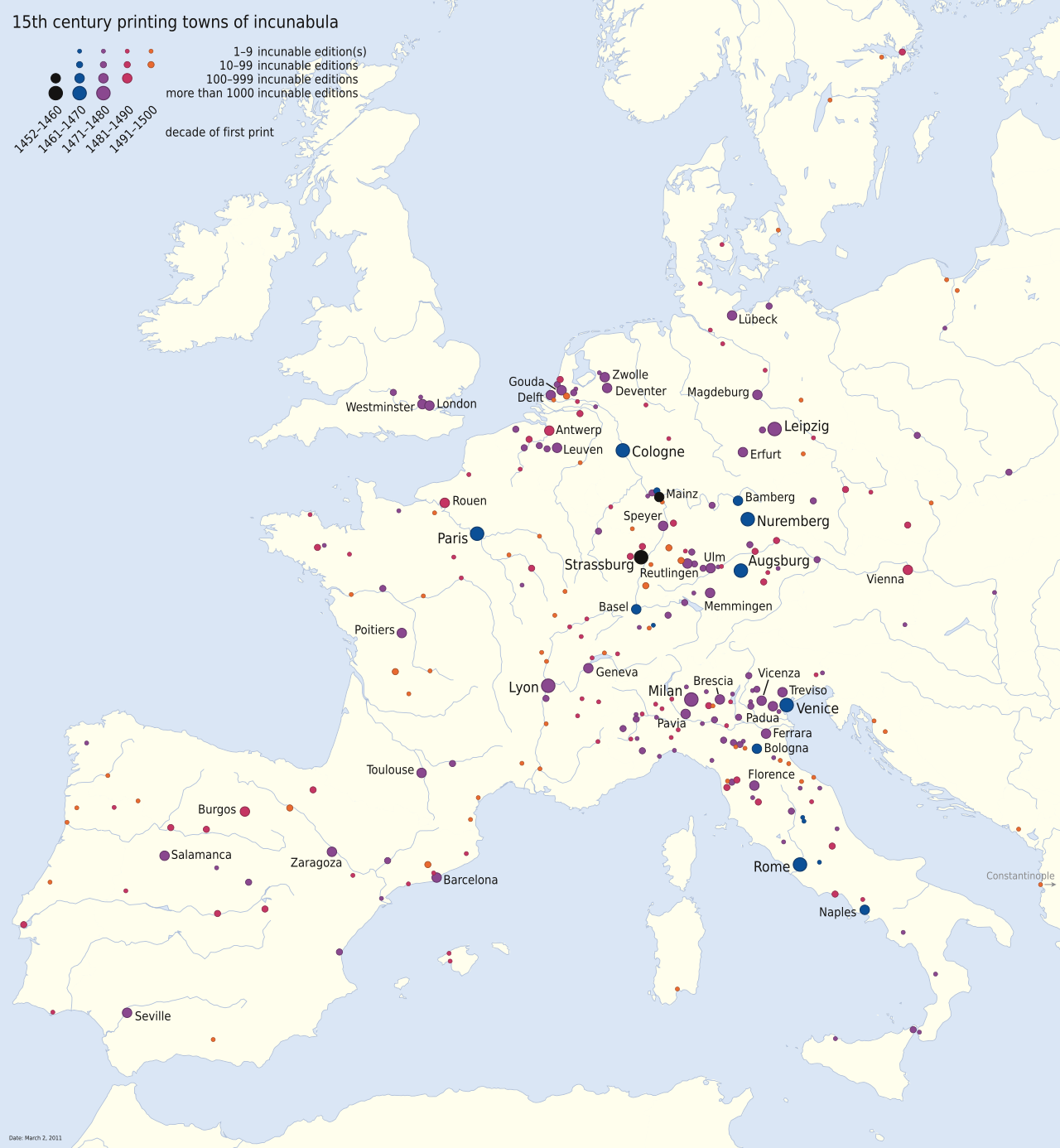
As these populations move across the geographic grid, they do not arrive empty-handed. They bring their languages, their technologies, and their beliefs. Spatial diffusion is the geographical process by which ideas, products, and cultural traits spread from one location to another. Whether we are tracking the historical spread of the printing press, the global adoption of the internet, or the reach of a new crop, spatial diffusion represents the ultimate triumph of human interaction over the vast, physical geography of the Earth.