Physical Geography and Location
Not sure you’re ready?
Take the ~3-minute readiness diagnostic and see where you stand.
Imagine taking a perfectly ripe orange, slicing it open, and attempting to press the peel entirely flat against your desk. The peel will warp, tear, and inevitably distort. This is the magnificent, fundamental problem of physical geography: how do we accurately represent a massive, three-dimensional, ever-shifting sphere on a flat two-dimensional surface so that a child can understand it? When teaching elementary students about mapping, location, and the Earth's physical systems, you are not merely asking them to memorize definitions. You are giving them the cognitive tools to translate a flat piece of paper into a dynamic, living planet.
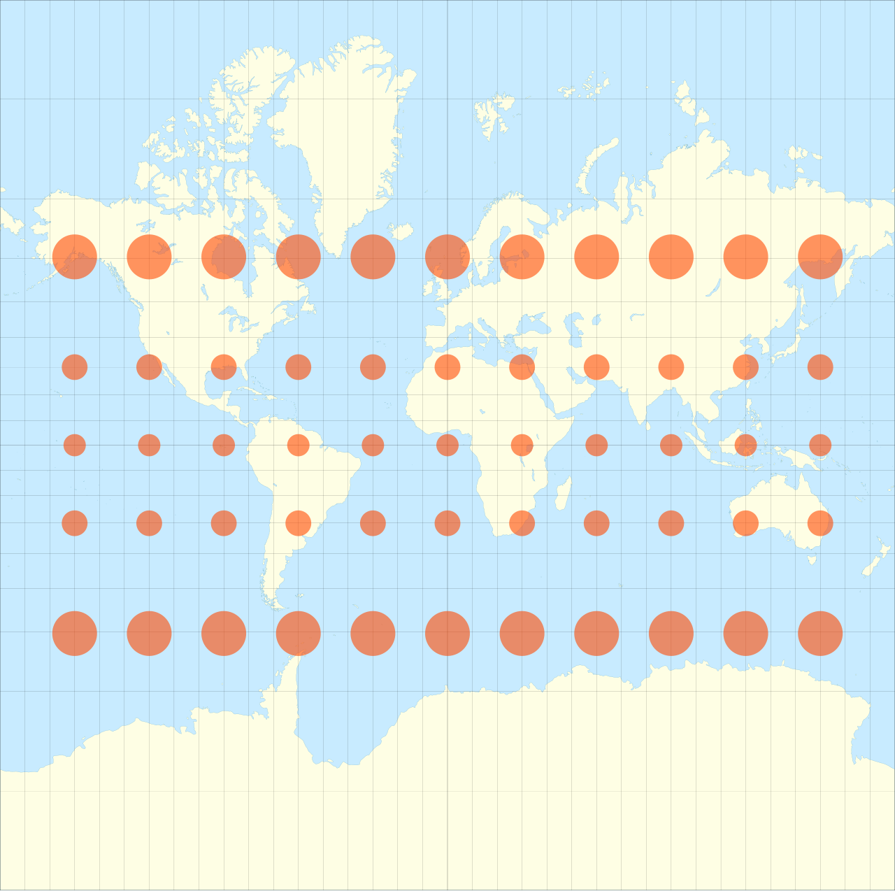
To teach geography effectively, you must understand both the mechanics of the Earth and the mechanics of a child's spatial reasoning. Let us break down the essential concepts of mapping, location, and the natural forces that continuously sculpt our world.
A map is a deeply abstracted model of reality. Children are highly literal thinkers, so the jump from a physical landscape to a symbolic piece of paper requires careful scaffolding. To read this model, students must master its foundational tools.
Every map relies on three primary translation devices:
- The Map Legend: A map legend explains the meaning of all symbols, lines, and colors used on a specific map. It is the dictionary for the map's visual language.
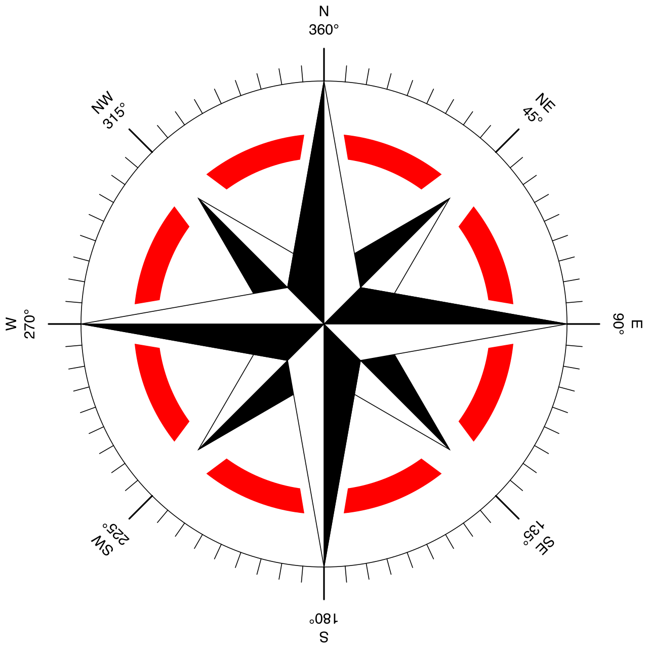
- The Compass Rose: A compass rose indicates the cardinal directions of North, South, East, and West on a map.
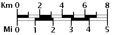
- The Map Scale: A map scale represents the proportional relationship between a measured distance on the map and the actual distance on Earth. It allows a student to look at two inches on paper and understand it represents two hundred miles of actual soil.
The Three Lenses of Cartography
We look at the Earth through different lenses depending on the information we need.
- Physical Maps: A physical map displays natural landforms and water features such as mountains, rivers, lakes, and deserts. It answers the question: What has nature built here?
- Political Maps: A political map displays human-made boundaries such as the borders of countries, states, and cities. It answers the question: How have humans divided this space?
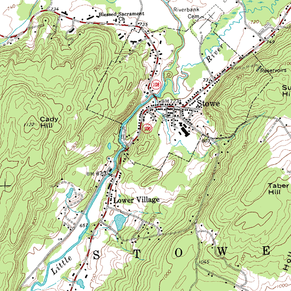
- Topographical Maps: A topographical map uses contour lines to represent the elevation and three-dimensional shape of the land.
Topographical maps are particularly fascinating because they force the brain to see mountains and valleys in flat, concentric rings. The spacing of these contour lines is the secret to reading them: closer contour lines on a topographical map indicate a steeper geographical slope, while widely spaced contour lines on a topographical map indicate a gentle slope or relatively flat land.
Pedagogical Intervention: The "Up" Misconception When a child looks at a map hanging on a classroom wall, their brain is experiencing gravity. Therefore, a frequent and stubborn misconception is that elementary students often incorrectly assume that the top of a map always represents a higher physical elevation rather than the cardinal direction North. They believe rivers cannot flow "up" toward the top of a map (like the Nile River flowing North). You must explicitly decouple "North" from "Up" in their minds.
How do you find a specific spot on a massive, featureless ocean? You need a grid. We teach children two ways to describe where they are.
Relative location describes a place in relation to other known geographic locations or physical landmarks (e.g., "The library is three blocks past the oak tree"). But absolute location specifies an exact mathematical point on the Earth's surface using a geographic coordinate system. This coordinate system is built of latitude and longitude.
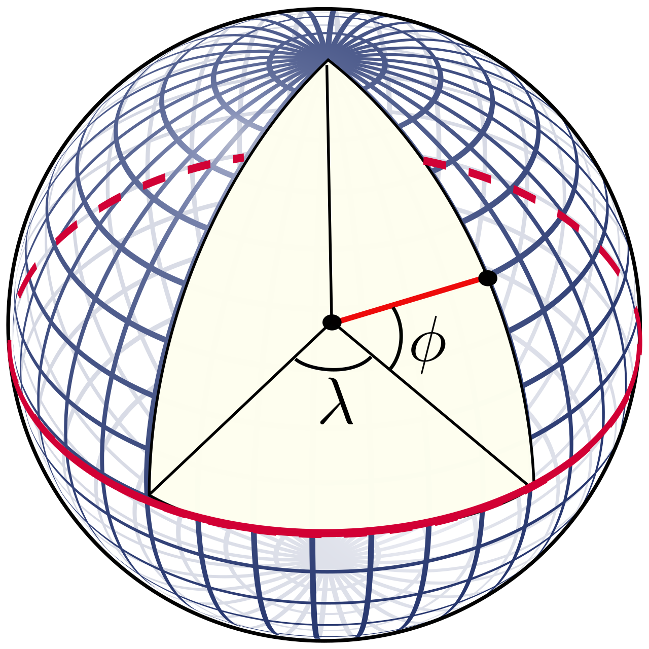
Latitude: The Ladder
Lines of latitude run east and west around the Earth parallel to the equator. However, because they are stacked like the rungs of a ladder, lines of latitude are used to measure the exact distance north or south of the equator.
- The Equator is the central line of latitude located at exactly zero degrees.
- It serves a critical geometric function: The equator divides the Earth into the Northern Hemisphere and the Southern Hemisphere.
Longitude: The Slices
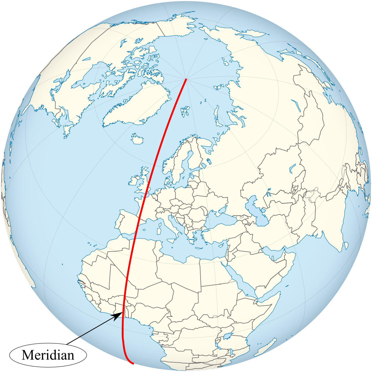
Lines of longitude run north and south from the North Pole to the South Pole. Think of the lines slicing an orange; they converge at the top and bottom. Because they are side-by-side, lines of longitude are used to measure the exact distance east or west of the Prime Meridian.
- The Prime Meridian is the central line of longitude located at exactly zero degrees (running right through Greenwich, England).
- Just as the equator splits the top and bottom, the Prime Meridian divides the Earth into the Eastern Hemisphere and the Western Hemisphere.
Pedagogical Intervention: The Grid Reversal A common elementary student misconception is reversing the functions of latitude and longitude lines. Because lines of latitude run horizontally, students mistakenly think they measure east-west distances. To correct this, remind them that while a ladder's steps run horizontally, you use them to climb up and down (North and South).
The International Date Line and Time Travel
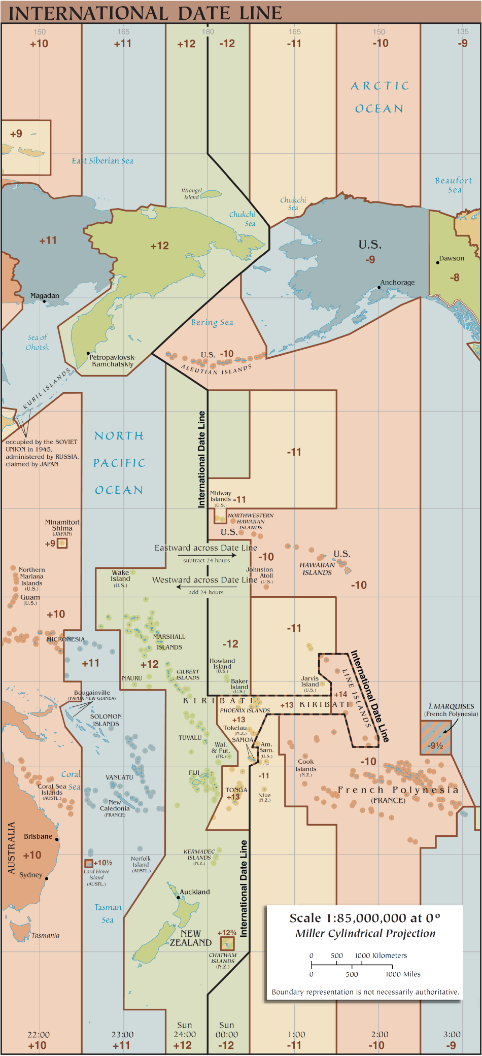
Because the Earth rotates, time is intrinsically linked to longitude. If you travel exactly halfway around the world from the Prime Meridian, you reach a conceptual boundary. The International Date Line is an imaginary line of longitude located approximately at 180 degrees.
Because of the way time zones accumulate, stepping across this line literally alters the calendar date.
- Crossing the International Date Line from west to east requires subtracting exactly one day from the calendar.
- Conversely, crossing the International Date Line from east to west requires adding exactly one day to the calendar.
Once students can navigate the globe, they must learn to name the features they encounter. The Earth's surface is a jigsaw puzzle of land and water interacting in distinct geometric patterns.
Teaching these in contrasting pairs helps students grasp their definitions more intuitively:
| Geographic Feature | Definition & Visualization |
|---|---|
| Plateau | A large geographic area of relatively flat land elevated high above sea level. Think of it as a mountain with its top sliced off. |
| Peninsula | A piece of land surrounded by water on exactly three sides. (Florida is a classic, tangible example for American students). |
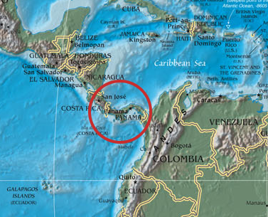
| Isthmus | A narrow strip of land connecting two much larger landmasses. (e.g., the Isthmus of Panama connecting North and South America). |
| Strait | A naturally formed, narrow body of water connecting two larger bodies of water. It is the exact aquatic opposite of an isthmus! |
| Delta | A triangular landform created by the deposition of sediment at the mouth of a river. |
A map represents a single moment in time, but the Earth is not static. It is a constantly shifting, churning engine. We must teach students that physical geography is the result of invisible processes, some happening in the blink of an eye, and others over eons.
The W-E-D Pipeline: Weathering, Erosion, and Deposition
How does solid bedrock turn into a sandy beach or a fertile delta? It requires a three-step geological assembly line.
- Weathering is the long-term geological process of breaking down rocks, soils, and minerals into smaller particles. This is the "hammer"—ice expanding in cracks, roots prying rocks apart, or wind blasting sand against stone.
- Erosion is the process of transporting weathered rock and soil particles from one geographic location to another. This is the "moving truck"—rivers carrying mud, or wind blowing dust.
- Deposition occurs when wind, moving water, or glacial ice drops transported geological sediment into a new location. When the river finally slows down at the ocean, it drops its sediment, building that triangular delta we defined earlier.
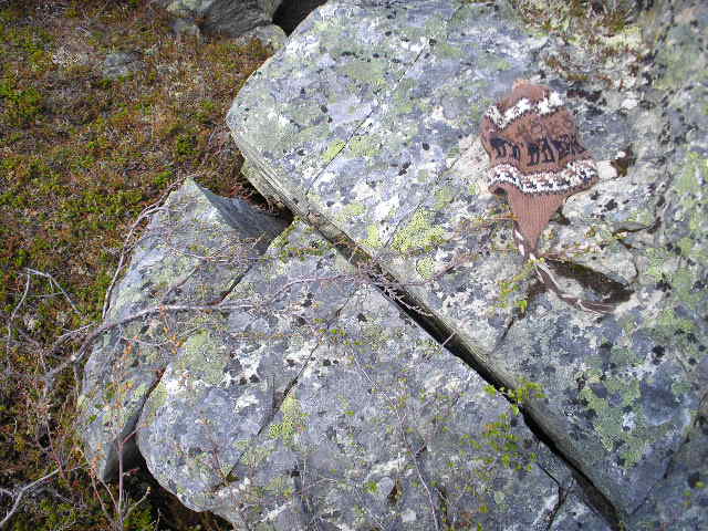
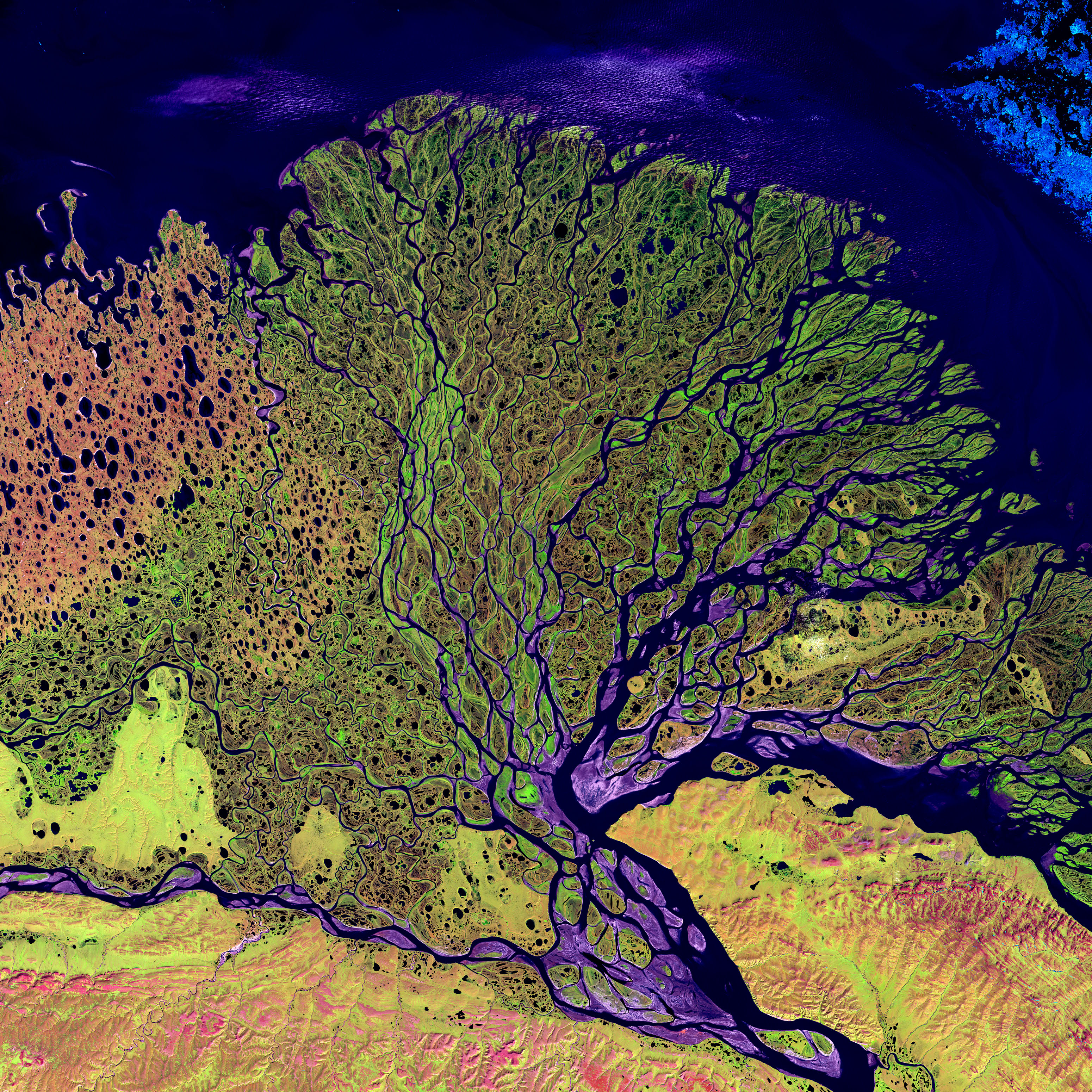
Pedagogical Intervention: The Weathering vs. Erosion Trap A frequent student misconception is using the terms weathering and erosion interchangeably. To the untrained eye, both seem to mean "rocks disappearing." As a teacher, you must isolate the actions: Weathering is breaking; Erosion is taking. If a rock is smashed by a hammer, that is weathering. If you sweep up the crumbs and throw them outside, that is erosion.
The Clock of the Earth: Short-Term vs. Long-Term Changes
Finally, students must categorize physical changes by the speed at which they alter the planet.
Short-Term, Rapid Changes
These events reshape the landscape in minutes, days, or weeks:
- Earthquakes cause short-term, rapid physical changes to the Earth's surface through sudden seismic shifts, instantly altering terrain and water flow.
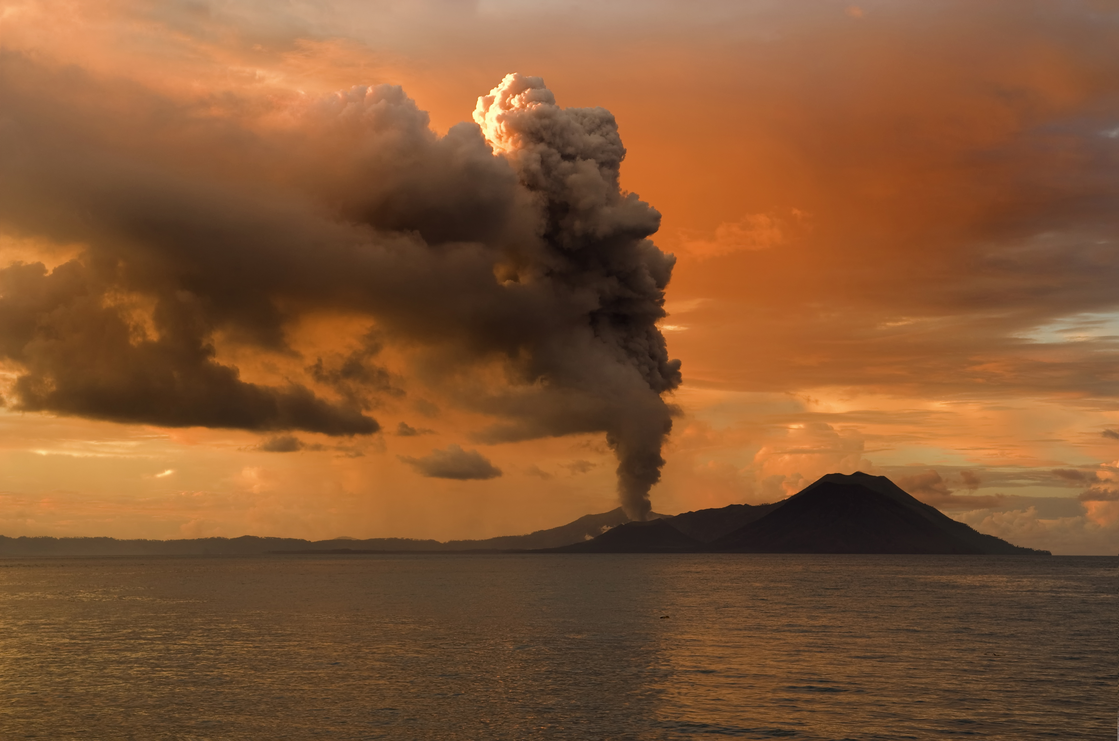
- Volcanic eruptions cause rapid physical changes to the landscape by instantly depositing massive volumes of new lava and ash, literally creating new land in a matter of hours.
- Landslides cause short-term physical changes by quickly moving large amounts of earth and rock down a steep slope, usually triggered by heavy rain or seismic activity.
Long-Term, Gradual Changes
These are the deep forces, invisible to the human lifespan, that engineer the grand architecture of our map.
- Plate Tectonics: Beneath our feet, plate tectonics is the long-term geological process of the Earth's solid lithospheric plates shifting over the molten mantle. When these massive puzzle pieces crash into one another, the crust crumples. The gradual collision of tectonic plates over millions of years creates long-term physical changes such as new mountain ranges.
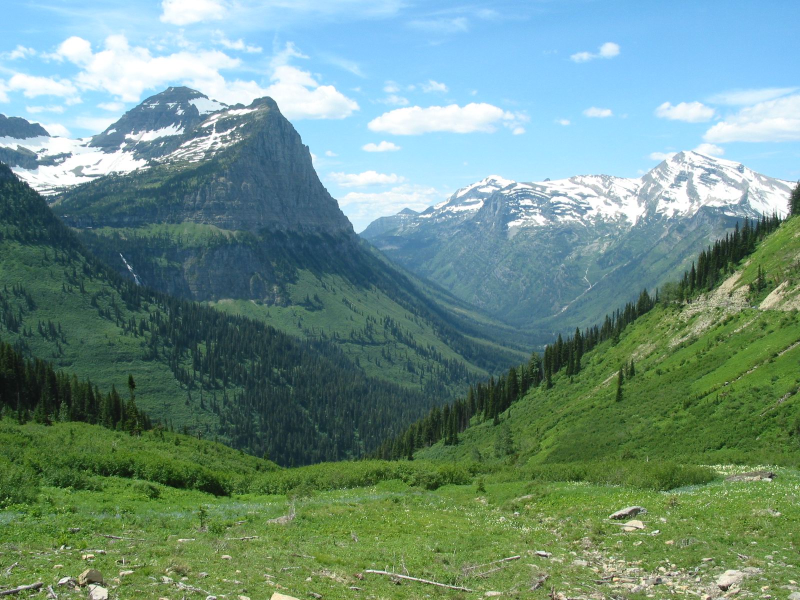
- Glaciation: Ice is an incredibly powerful sculptor. Glaciation is a long-term physical change where massive moving ice sheets permanently reshape the land by carving deep valleys. (Usually forming distinct U-shaped valleys, unlike the V-shaped valleys of rivers).
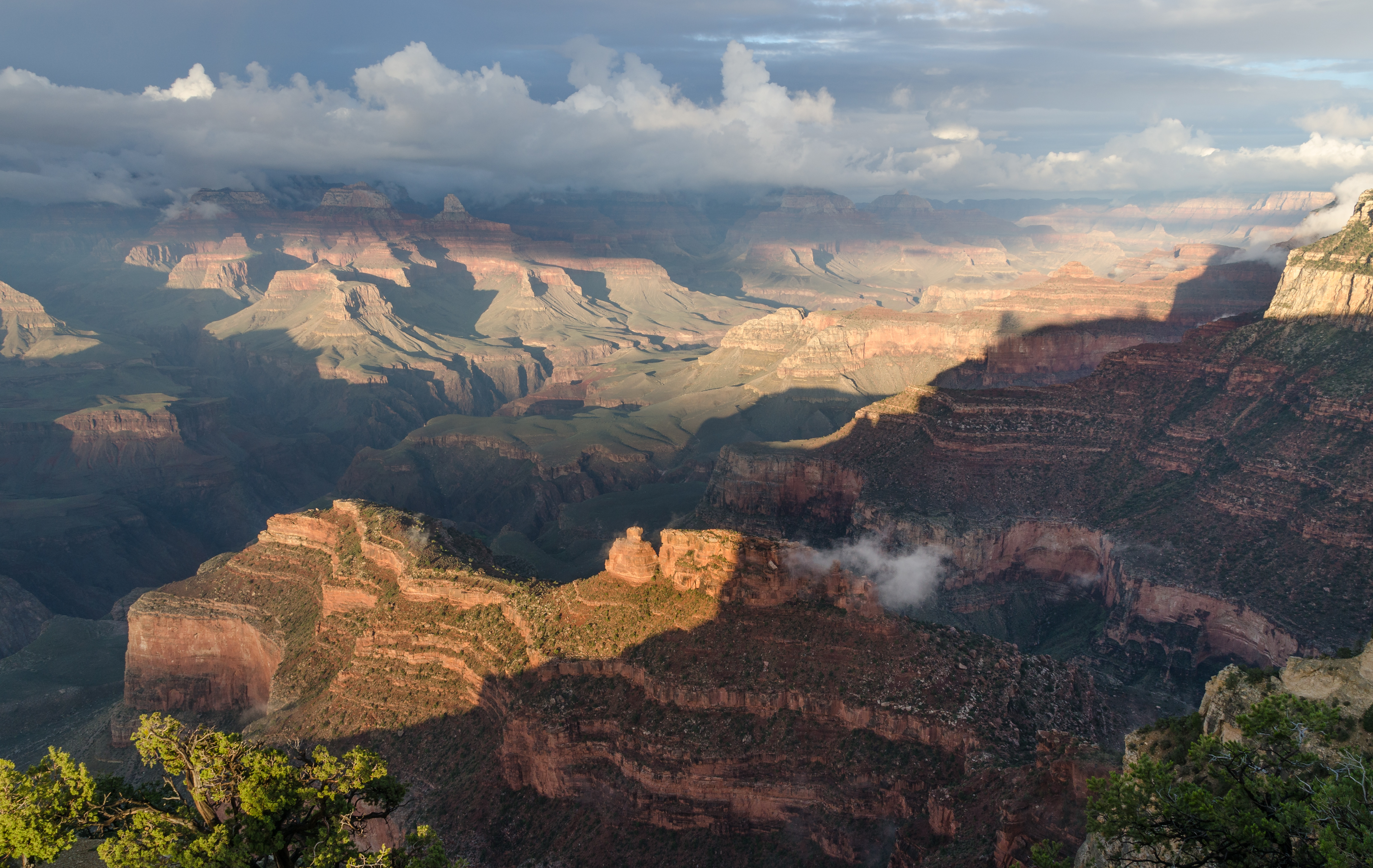
- Rivers: Water always wins in a battle against stone. Rivers cause long-term physical changes to the Earth by gradually carving deep canyons into the bedrock over millions of years. The Grand Canyon is nothing more than the Colorado River applying relentless friction over infinite time.
By mastering these concepts, you are prepared not just to pass an exam, but to invite your students into a breathtaking realization: the flat map hanging in your classroom is actually a blueprint of a living, breathing planet, waiting to be explored.