Weather, Climate, and Biogeology
Not sure you’re ready?
Take the ~3-minute readiness diagnostic and see where you stand.
When an eight-year-old looks out the classroom window at a sudden downpour, they see an isolated event: rain. The task of the elementary science educator is to transform that momentary observation into a profound understanding of dynamic, interconnected Earth systems. We are not merely teaching children to read a thermometer; we are guiding them to perceive the long-term rhythms of solar radiation, the geographical constraints that shape global climates, and the reciprocal relationship between the physical Earth and the biological organisms that relentlessly engineer it. To teach this content effectively, you must master not only the meteorological and biogeological facts, but the cognitive leaps your students must make to grasp them.
To a child, a snowstorm in April is a profound anomaly. To a meteorologist, it is simply a data point. The foundational step in earth science instruction is drawing a sharp, immovable line between weather and climate.
Weather describes the short-term state of the atmosphere at a specific time and place. It is what you get when you step outside today.
Climate describes the long-term average of weather patterns in a specific region over decades. It is what you expect when you pack your bags for a trip.
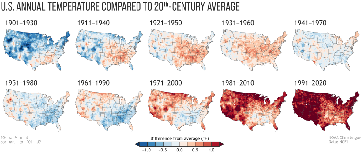
To establish this baseline, meteorologists typically use a 30-year period to determine the climate of a specific region. Why thirty years? Because atmospheric conditions are noisy. If you judge a baseball player by a single game (weather), you might think they are terrible. If you look at their batting average over a decade (climate), you discover they are an all-star.
The Classic Student Misconception
A common elementary student misconception is confusing short-term weather events with long-term climate trends. You will inevitably hear a student say, "It's freezing outside today; global warming isn't real!" As an educator, you must recognize that this stems from a developmental difficulty in conceptualizing deep time and large-scale averages. Your instructional response must be to shift their focus from the single data point to the aggregate trend.
Before students can understand patterns, they must observe and measure. Weather conditions include temperature, precipitation, wind speed, wind direction, and cloud cover. We teach students to quantify these variables using specific instruments, removing human subjectivity from the observation:
- A thermometer is an instrument used to measure air temperature.
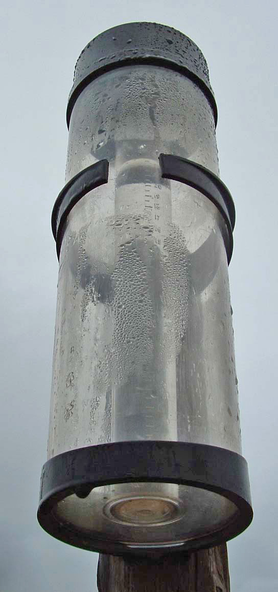
- A rain gauge is an instrument used to measure the amount of liquid precipitation over a set period.
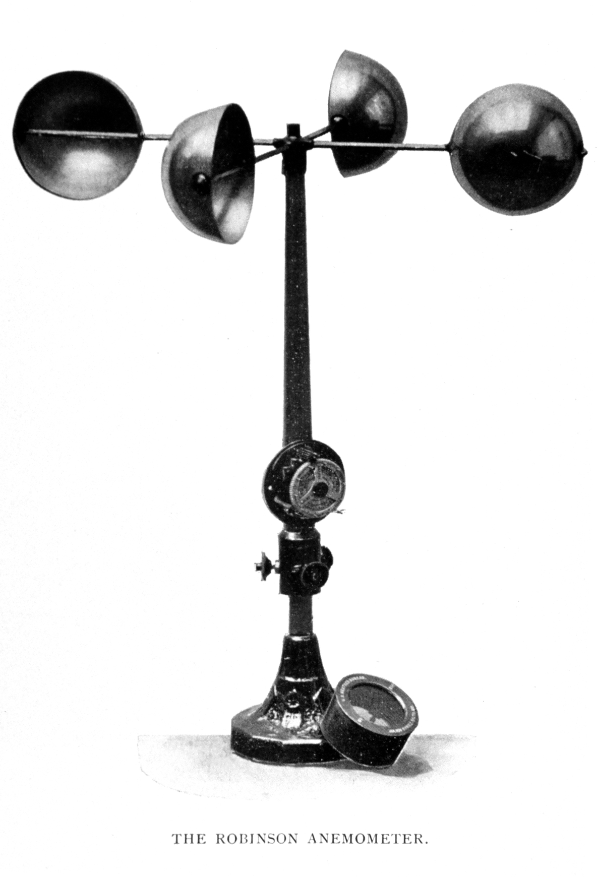
- An anemometer is an instrument used to measure wind speed.
- A weather vane is an instrument used to indicate wind direction.
Instructional Decision-Making: Merely showing these tools is insufficient. Observing weather conditions over time allows scientists to identify predictable seasonal patterns. You must have your students act as scientists. Graphing daily temperature over several months helps elementary students visually identify seasonal weather patterns. When a child plots temperatures daily from September to January, the invisible geometry of the solar system becomes a visible, downward-sloping line on their graph paper.
Why does that temperature line slope downward in the winter? Children often assume the Earth physically moves further away from the Sun. As a teacher, you must correct this with the actual mechanics: Earth's axial tilt causes changes in the angle and intensity of sunlight reaching different regions throughout the year.
Imagine shining a flashlight straight down at a piece of paper. The light is intensely focused in a tight circle. Now, tilt the paper. The same amount of light spreads out into a long, faint oval. The total energy is the same, but its intensity per square inch has plummeted. This is what happens to the Earth. The changing angle of sunlight throughout the year creates predictable seasonal weather patterns.
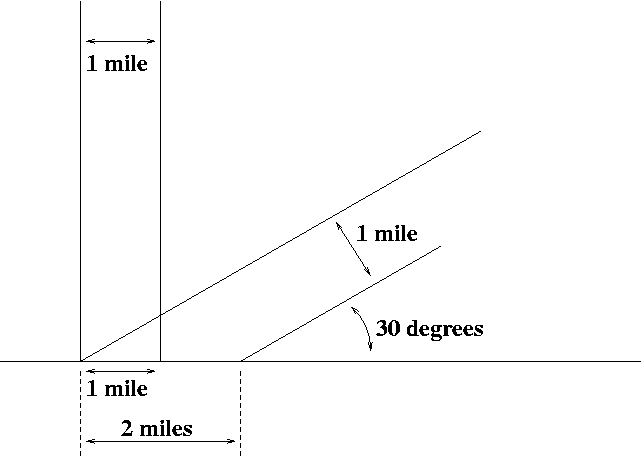
Because of the Earth's spherical shape, the equator receives more direct sunlight year-round than the Earth's poles. Consequently, regions near the equator generally have warmer climates than regions near the poles.
If latitude were the only factor, every city on the 40th parallel would share an identical climate. Yet, San Francisco, California and Denver, Colorado experience vastly different realities.
Global Comparison in the Classroom
To build a holistic mental model, use data visualization. Comparing global temperature maps helps students understand that different regions experience different climates simultaneously. When they see a heat map showing a freezing January in New York alongside a sweltering January in Sydney, they begin to grasp the vastness of the Earth system.
Beyond latitude, three critical geographic features dictate a region's climate:
- Water: Water has an incredible thermal inertia—it is slow to warm up and slow to cool down. Therefore, proximity to large bodies of water moderates the climate of coastal regions. Because the ocean acts like a giant thermal shock-absorber, coastal regions typically experience less extreme temperature changes than inland regions.
- Altitude: As you climb a mountain, the air pressure drops, causing the air to expand and cool. Air temperature generally decreases as altitude increases. Therefore, higher elevation regions generally have cooler climates than lower elevation regions at the same latitude.
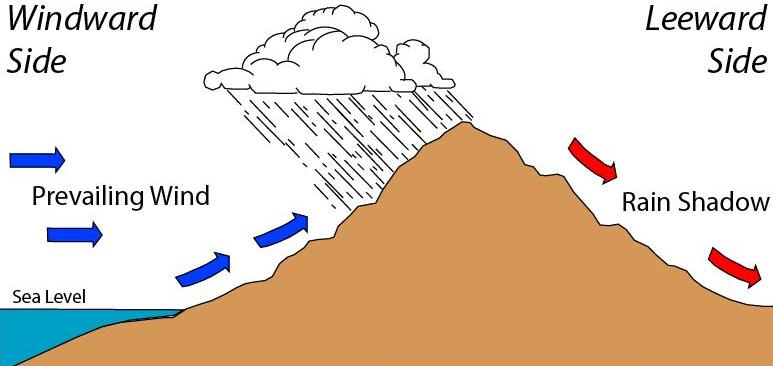
- Topography: Mountains disrupt the movement of moisture. Mountains can create a rain shadow effect. When moist ocean air hits a mountain range, it is forced upward. It cools, condenses, and dumps massive amounts of rain on the windward side. By the time the air crests the peak and sinks down the other side, it is parched. The rain shadow effect causes the leeward side of a mountain to be significantly drier than the windward side.
The Five Climate Zones
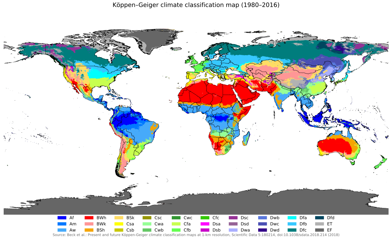
The intersection of latitude, altitude, and topography results in distinct global climates. Earth scientists classify these into the five main climate zones: tropical, dry, temperate, continental, and polar.
Elementary curricula typically focus on three starkly contrasting zones to establish foundational understanding:
- Tropical climates are characterized by high temperatures and significant rainfall year-round. (Think of the lush Amazon basin, perfectly situated at the equator).
- Polar climates are characterized by extremely low temperatures and minimal precipitation. (Antarctica is technically a freezing desert!).
- Dry climates experience more evaporation than precipitation. (The air pulls water out of the environment faster than rain can replenish it).
Historically, science education taught biology and geology as separate silos. Today, we recognize that the Earth and its lifeforms are a single, interacting system.
The Adaptation Misconception
A common elementary student misconception is that organisms only adapt to environments without actively changing the physical environments themselves. Children view nature as a theater: the environment is the stage, and animals are merely actors who must learn to survive on it.
You must flip this script. The actors are tearing up the floorboards and knocking down the walls. Plants and animals actively alter their physical environments to meet their survival needs. Your students must be able to construct arguments based on evidence for how this happens.
Consider these prime pedagogical examples of biological terraforming:
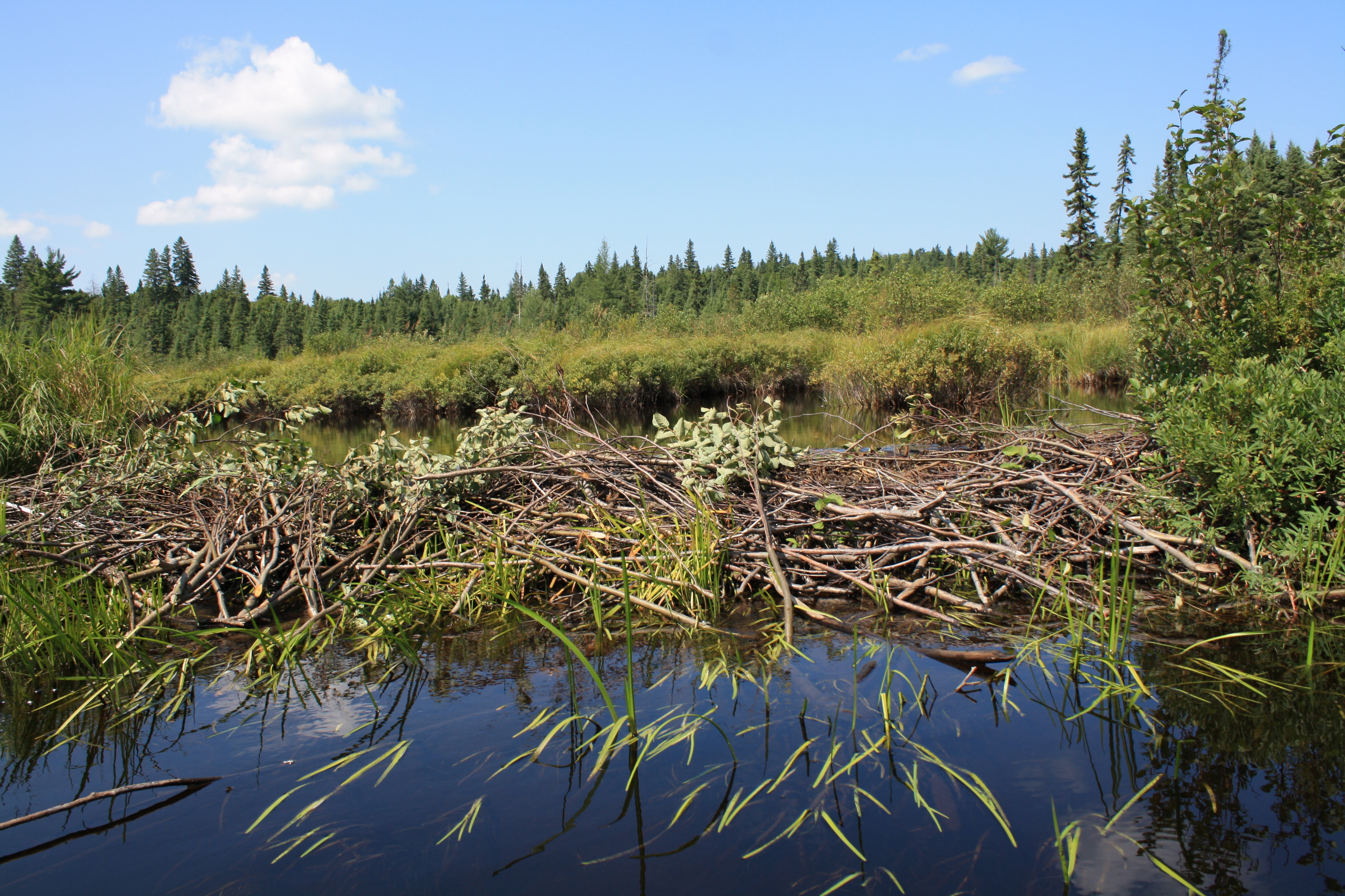
- The Beaver: Beavers do not just look for deep water; they manufacture it. Beavers build dams across streams to create deep ponds for protection from predators. The consequences of this action ripple through the ecosystem. Beaver dams alter the local flow of water and create new wetland habitats, transforming swift-moving streams into sprawling, biologically diverse marshes.
- The Earthworm: Earthworms burrow through the ground to find food and shelter. To a child, this seems insignificant. To a geologist, earthworms are microscopic plows. Earthworm burrowing aerates the soil and improves water infiltration, radically changing the soil's chemistry and physical structure, which in turn allows immense forests to thrive.
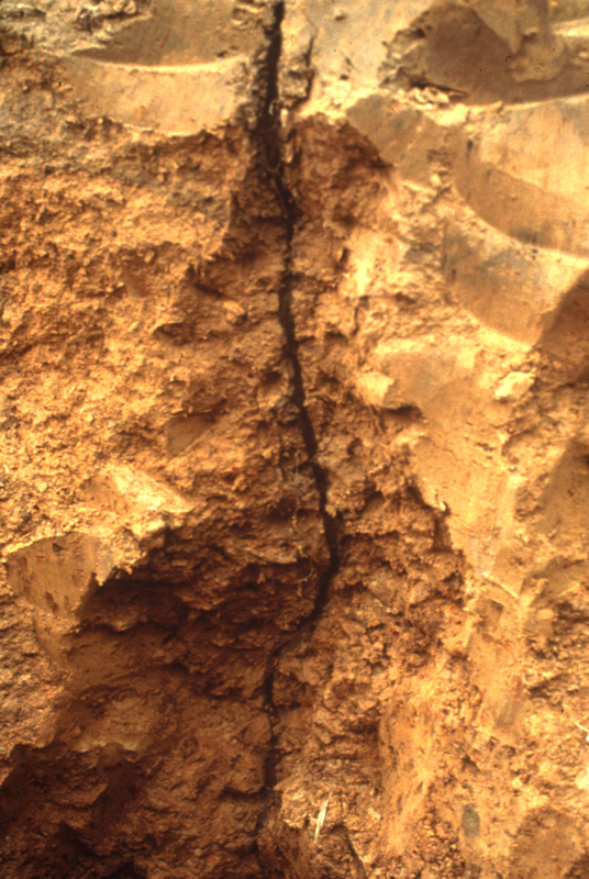
- The Plant: Even stationary life destroys and rebuilds. Plant roots grow into small cracks in rocks to access water and nutrients. As the plant grows, so do the roots. Expanding plant roots exert pressure that can break rocks apart over time in a process called biological weathering. Forests literally pulverize mountains into soil.
The Ultimate Terraformer
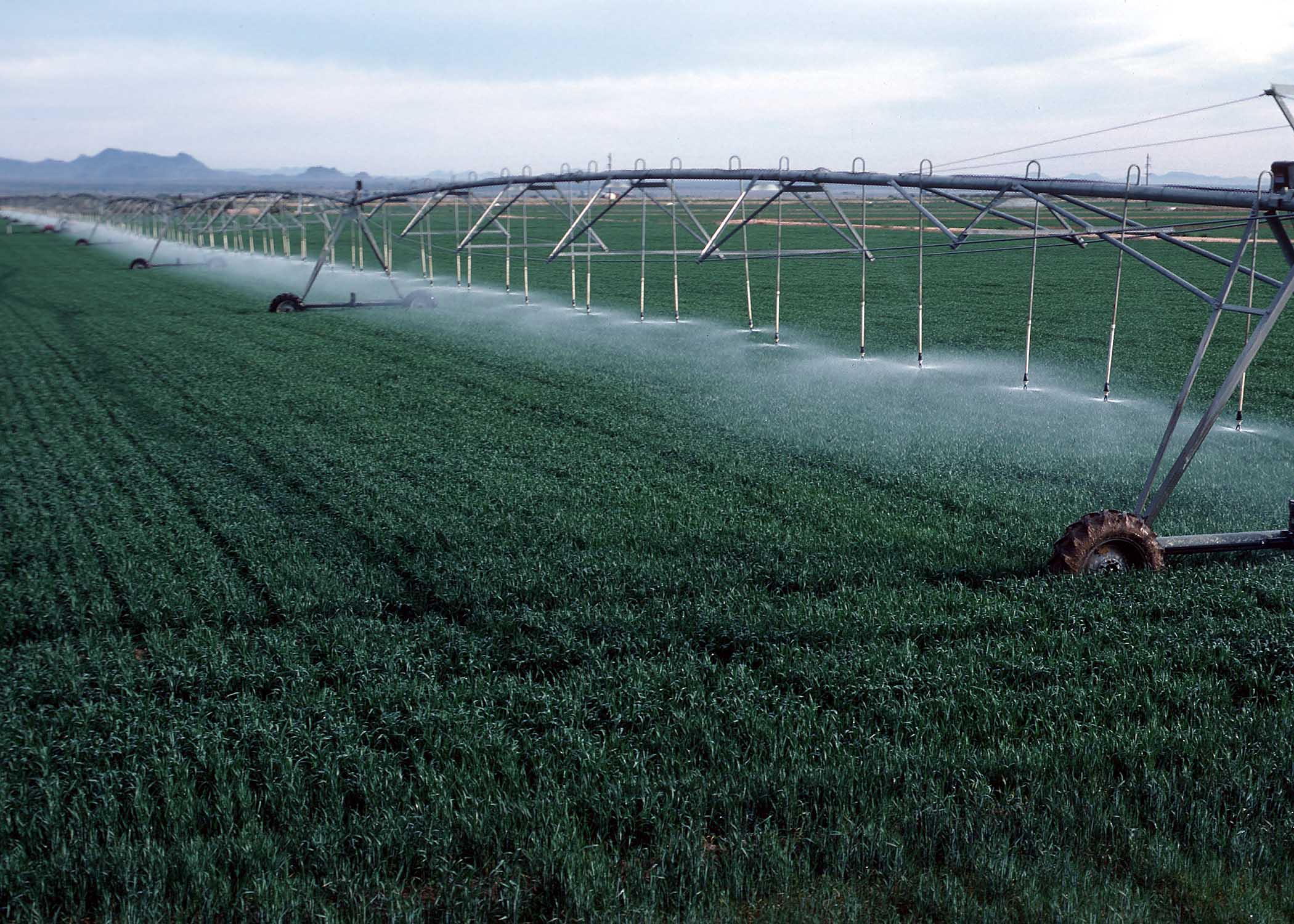
Finally, students must look in the mirror. While beavers build dams and roots crack stones, no species alters the physical Earth like we do. Humans represent the most significant biological force altering global physical environments. We do not merely adapt to the Earth; we remake it in our image. Humans modify environments on a large scale through agriculture, urbanization, and resource extraction.
When you teach weather, climate, and biogeology, you are giving your students the conceptual tools to read the world. They will no longer just see "rain," "mountains," or "trees." They will see the elegant, physical machinery of the atmosphere, the profound influence of geography on climate, and the relentless, environment-shaping power of life itself.