Earth's Materials and Systems
Not sure you’re ready?
Take the ~3-minute readiness diagnostic and see where you stand.
To understand a mountain, you cannot merely look at the rock. You must look at the cloud hovering above it, the forest clinging to its flanks, and the stream carving its base. The Earth does not operate as a museum of isolated, static displays; it is a massive, intricate engine. Every grain of sand on a beach and every cloud in the sky is the product of constant, relentless exchange. For an educator, teaching Earth science is not about handing students a list of vocabulary words—it is about training them to see the invisible gears of a dynamic machine operating right outside their classroom window.
The Earth consists of four major interacting subsystems known as the geosphere, hydrosphere, atmosphere, and biosphere. These are not separate containers; they are overlapping domains that constantly trade materials and energy.
- The Geosphere: This encompasses the solid Earth. When your students pick up a pebble, dig in the dirt, or draw a mountain range, they are interacting with the geosphere. Rocks, minerals, soils, and landforms make up the geosphere.
- The Hydrosphere: This encompasses all liquid and solid water found on Earth, from the deepest oceans to the frost on a morning windowpane.
- The Atmosphere: This is the envelope of gases surrounding the Earth, providing the air we breathe and the climatic engine that drives surface weather.
- The Biosphere: This contains all living organisms on Earth, from microscopic soil bacteria to redwood trees and human beings.
Earth's four major systems continuously interact by exchanging matter, and they continuously interact by exchanging energy. Because of this deep interconnection, a change in one Earth system frequently causes subsequent changes in other Earth systems.
Consider a rainstorm. Rain falling from the atmosphere onto the geosphere demonstrates an interaction between two Earth systems. The water (matter) and the kinetic impact of the drops (energy) move from the sky to the rock. Similarly, a tree growing in a forest illustrates a biological and atmospheric exchange: plants in the biosphere absorb carbon dioxide directly from the atmosphere to perform photosynthesis.
The Illusion of Abundant Water
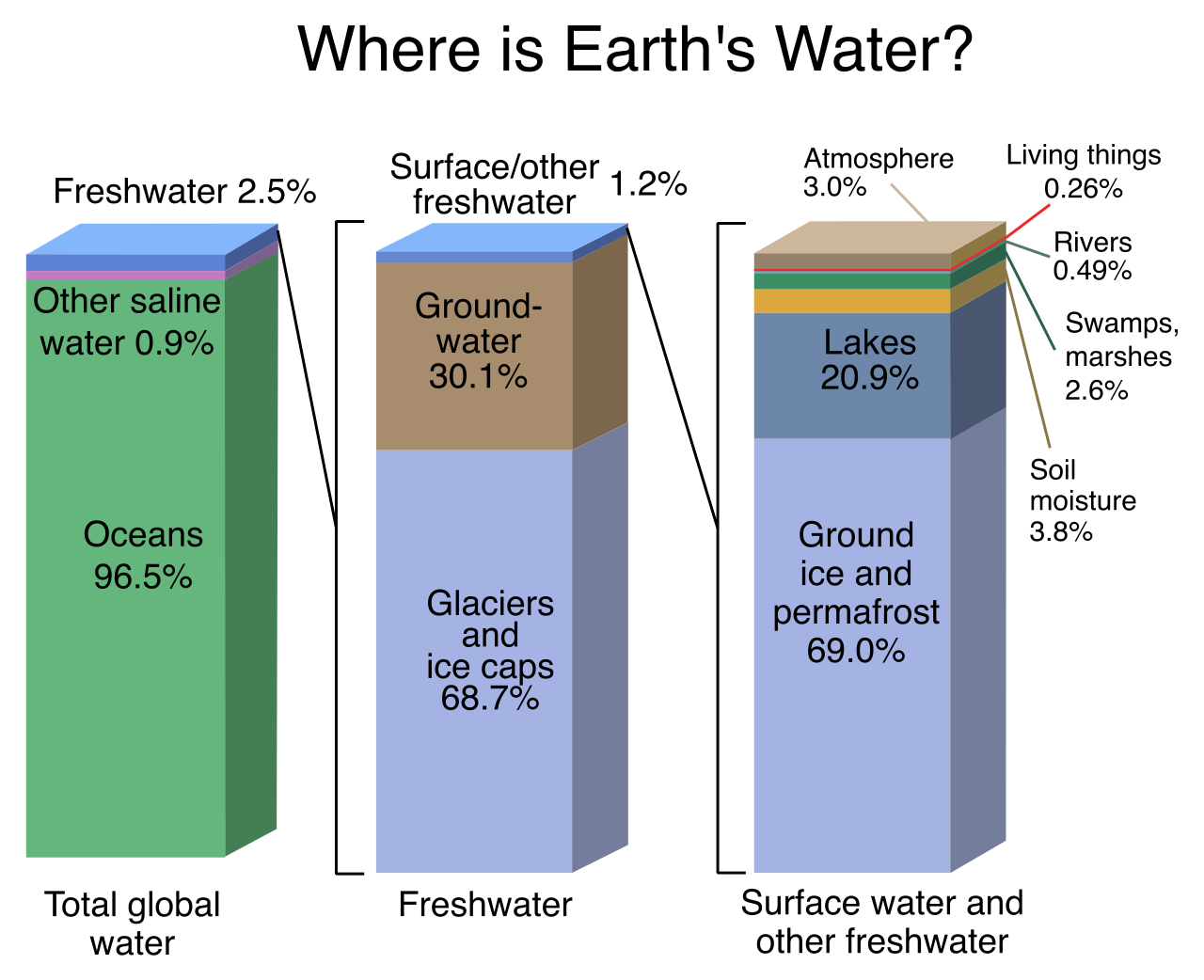
When we examine the hydrosphere closely, we encounter a reality that frequently surprises elementary students. Because maps show a planet dominated by blue, students assume drinking water is limitless. In reality, the vast majority of the water on Earth is saltwater located in the oceans.
Only a small fraction of water on Earth is fresh water. And even then, it is not sitting in the local creek. Glaciers contain a large portion of Earth's fresh water, locked away in ice. Underground aquifers contain a large portion of Earth's fresh water, hidden from view beneath our feet. Lakes and rivers—the water sources we see and interact with daily—contain a very small fraction of Earth's fresh water.
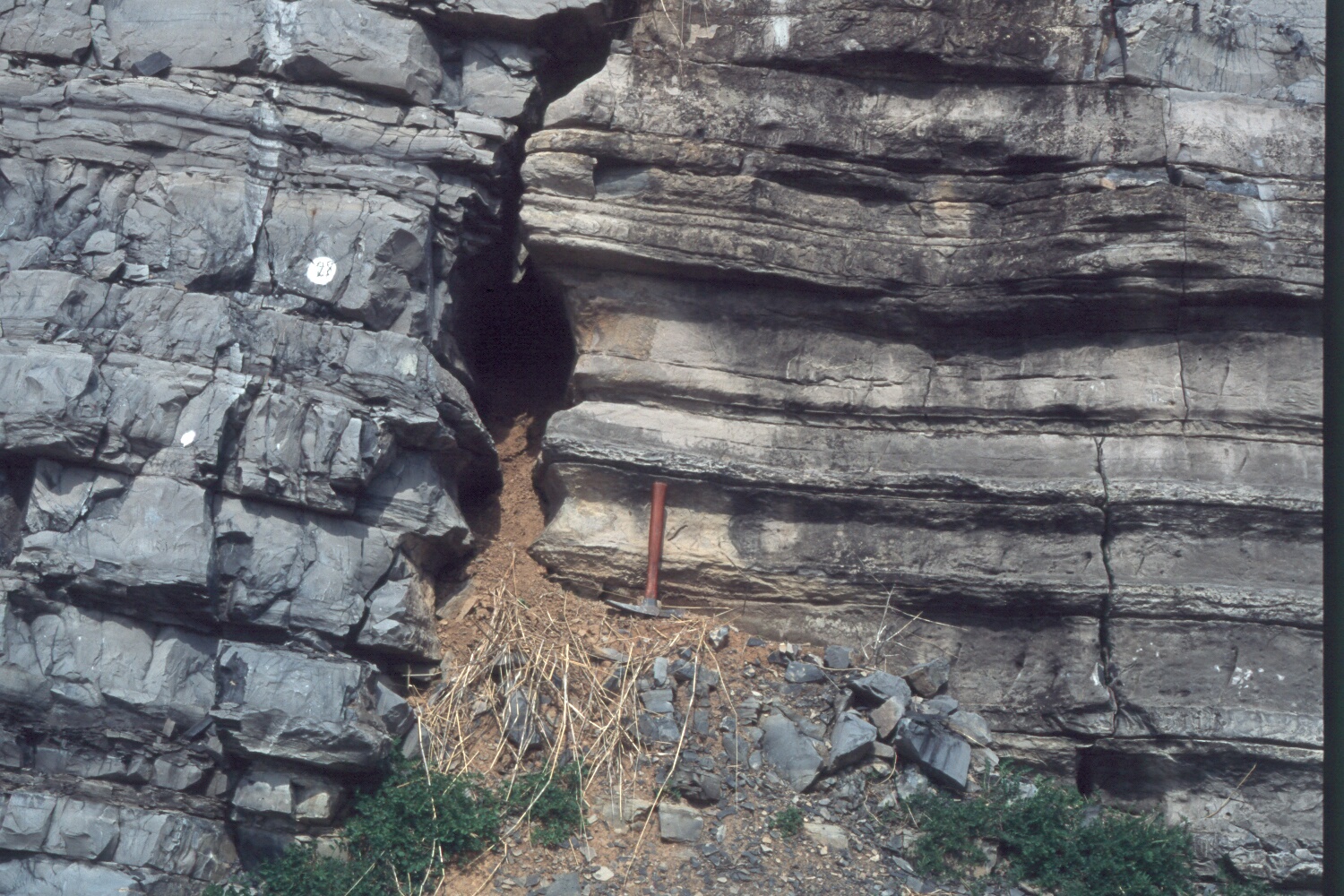
When students look at a boulder, they see permanence. A common, pervasive elementary student misconception is that solid rocks cannot change shape or size over time. As educators, our job is to reveal that the Earth is a constantly shifting canvas, driven by three distinct geological processes: weathering, erosion, and deposition.
Weathering is the physical or chemical process of breaking down rocks, soils, and minerals.
Erosion is the geological process of transporting weathered rock and soil from one location to another.
Deposition occurs when eroded sediments settle and accumulate in a new location.
Pedagogical Warning: Another common elementary student misconception is using the terms weathering and erosion interchangeably. You must carefully disentangle these concepts. Use the maxim: Weathering is the breaking; erosion is the taking. You cannot transport a mountain without first breaking it down into movable pieces, and you cannot deposit new landforms without first carrying the raw materials.
Physical vs. Chemical Weathering
We must categorize how rocks break down. Does the rock merely shatter, or does it transform?
- Physical Weathering: This breaks rocks into smaller pieces without changing the chemical composition of the rocks. If you smash a piece of granite with a hammer, it is still granite.
- Chemical Weathering: This changes the actual chemical composition of rocks. The rock is not just broken; it is altered at the molecular level. A perfect example occurs when acid rain falling on limestone demonstrates chemical weathering. The acid reacts with the calcium carbonate in the limestone, dissolving it and forming new chemical compounds.
The rate at which these rocks break down is not uniform. The rate of rock weathering depends heavily on the specific type of rock (soft sandstone degrades faster than dense quartzite) and depends heavily on local climate conditions (hot, wet environments accelerate chemical weathering; cold environments accelerate physical ice wedging).
Who are the actors on this geological stage? Water, wind, ice, and living organisms all act as primary agents for weathering, and all four simultaneously act as primary agents for erosion.
1. Water
Water is the undisputed champion of sculpting the Earth. Water acts as a primary agent for weathering (dissolving rock) and acts as a primary agent for erosion (carrying the sediment away).
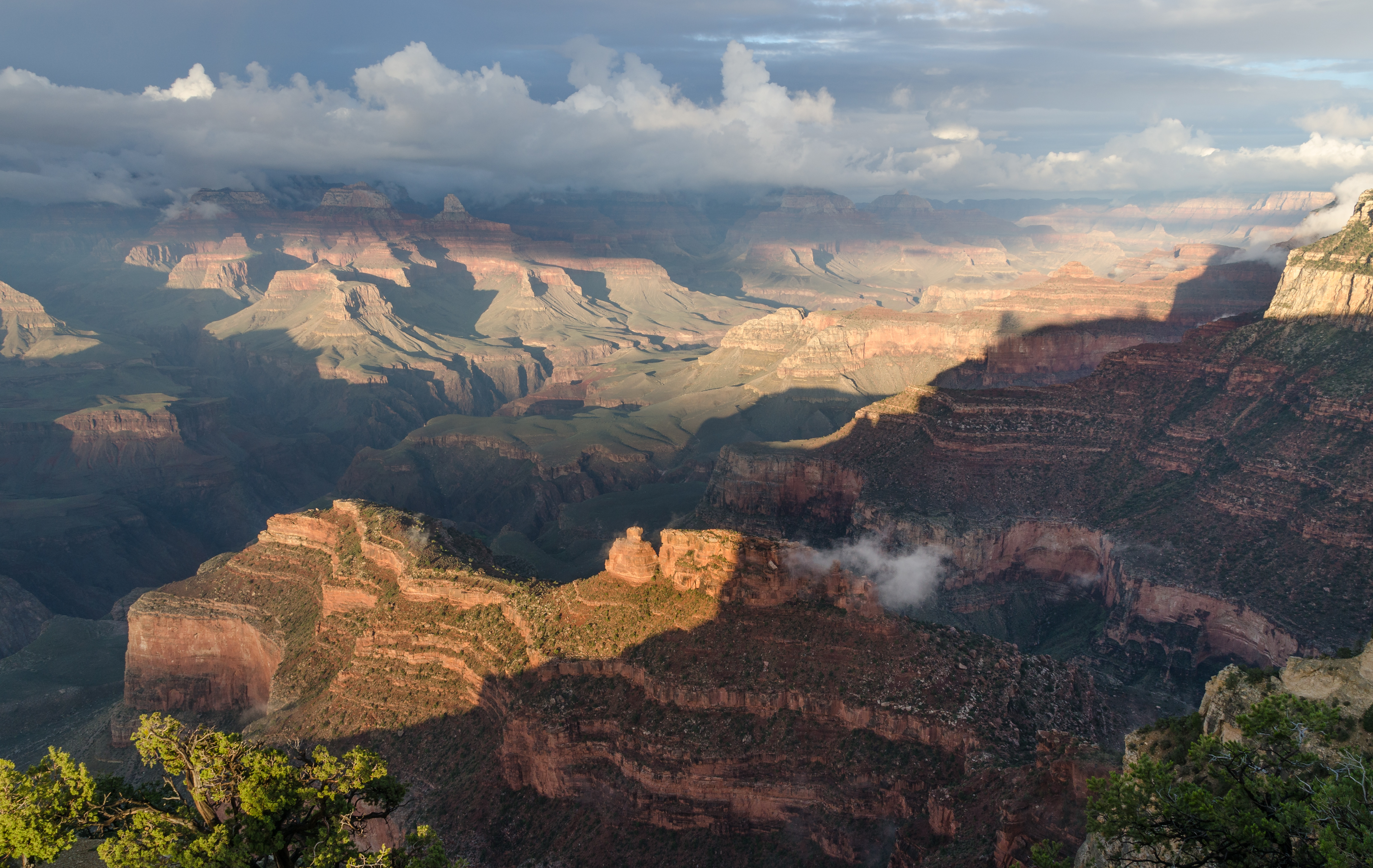
The kinetic energy of water dictates its carrying capacity. Faster moving water carries larger sediment particles compared to slower moving water. When a rushing mountain river hits a flat plain, it slows down, dropping its heavy boulders first, followed by pebbles, and finally fine silt. Over millions of years, rivers carve V-shaped valleys through the continuous flow of liquid water eroding the underlying geosphere.
2. Ice
Ice acts as a primary agent for weathering and acts as a primary agent for erosion.
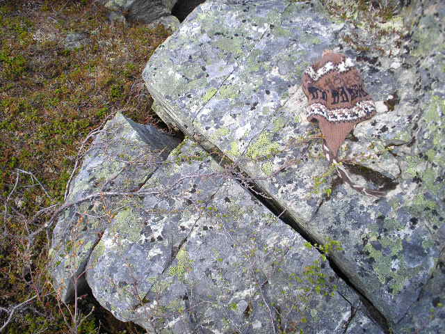
When liquid water seeps into the cracks of a rock, it rests. But as temperatures drop, liquid water expanding as the water freezes inside rock cracks causes physical weathering. This process, known as ice wedging, literally pries massive boulders apart with hydraulic force.
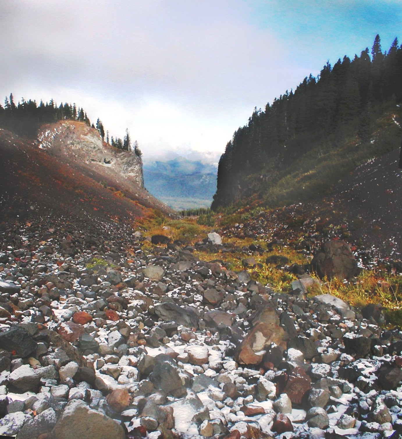
On a macro scale, glaciers are slow-moving rivers of ice. Glaciers carve U-shaped valleys through the slow movement of massive ice sheets eroding the underlying geosphere. Unlike rivers, which slice downward to form a "V", glaciers bulldoze everything in their path, leaving broad, wide-bottomed "U" shaped trenches in the mountains.
3. Wind
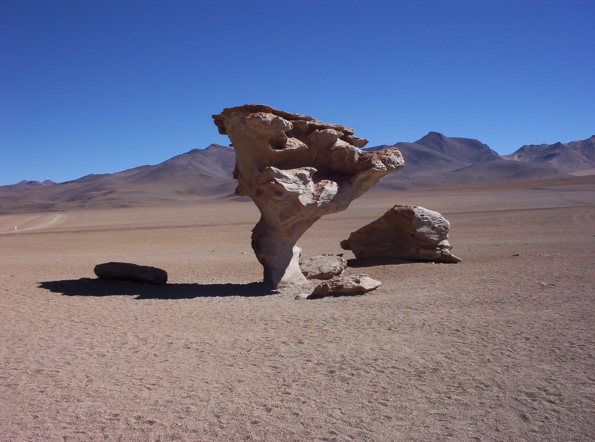
Wind acts as a primary agent for weathering (sandblasting rock faces) and acts as a primary agent for erosion (carrying dust and sand across continents). Wind erosion occurs most frequently in dry environments lacking protective vegetation cover. Without the roots of plants to hold soil down, and without moisture to clump soil particles together, the wind easily strips away the top layers of the geosphere.
4. Living Organisms
Students rarely view a dandelion as a geological wrecking ball, but living organisms act as primary agents for weathering and act as primary agents for erosion.
Plant roots can grow into narrow rock crevices in search of moisture and nutrients. The growth of plant roots inside rock crevices physically breaks the rock apart over time. Conversely, animals burrowing into the ground displace soil, initiating the process of biological erosion.
Because erosion can destroy farmland, undermine roads, and collapse coastal properties, human beings intervene. Humans engineer specific design solutions to slow wind and water from altering natural land shapes, and in many cases, engineer specific design solutions to completely prevent wind and water from altering natural land shapes.
Teaching this requires shifting from pure Earth science to applied engineering. When evaluating erosion control design solutions, engineers (and your students) cannot just pick the strongest material. Evaluating erosion control design solutions requires analyzing material cost constraints (building a titanium wall is too expensive) and analyzing environmental impact constraints (paving a riverbed destroys the local ecosystem).
Here are the primary design solutions engineers use to combat Earth's agents of erosion:
| Design Solution | Purpose & Mechanism | Earth System Addressed |
|---|---|---|
| Vegetation / Root Anchors | Plant root systems anchor soil in place. Anchoring soil with plant roots prevents soil erosion. | Hydrosphere & Atmosphere (Water & Wind) |
| Retaining Walls | Retaining walls are engineered physical barriers built to hold back soil on steep slopes. By physically catching the soil, retaining walls prevent soil erosion on steep slopes. | Hydrosphere (Gravity & Water runoff) |
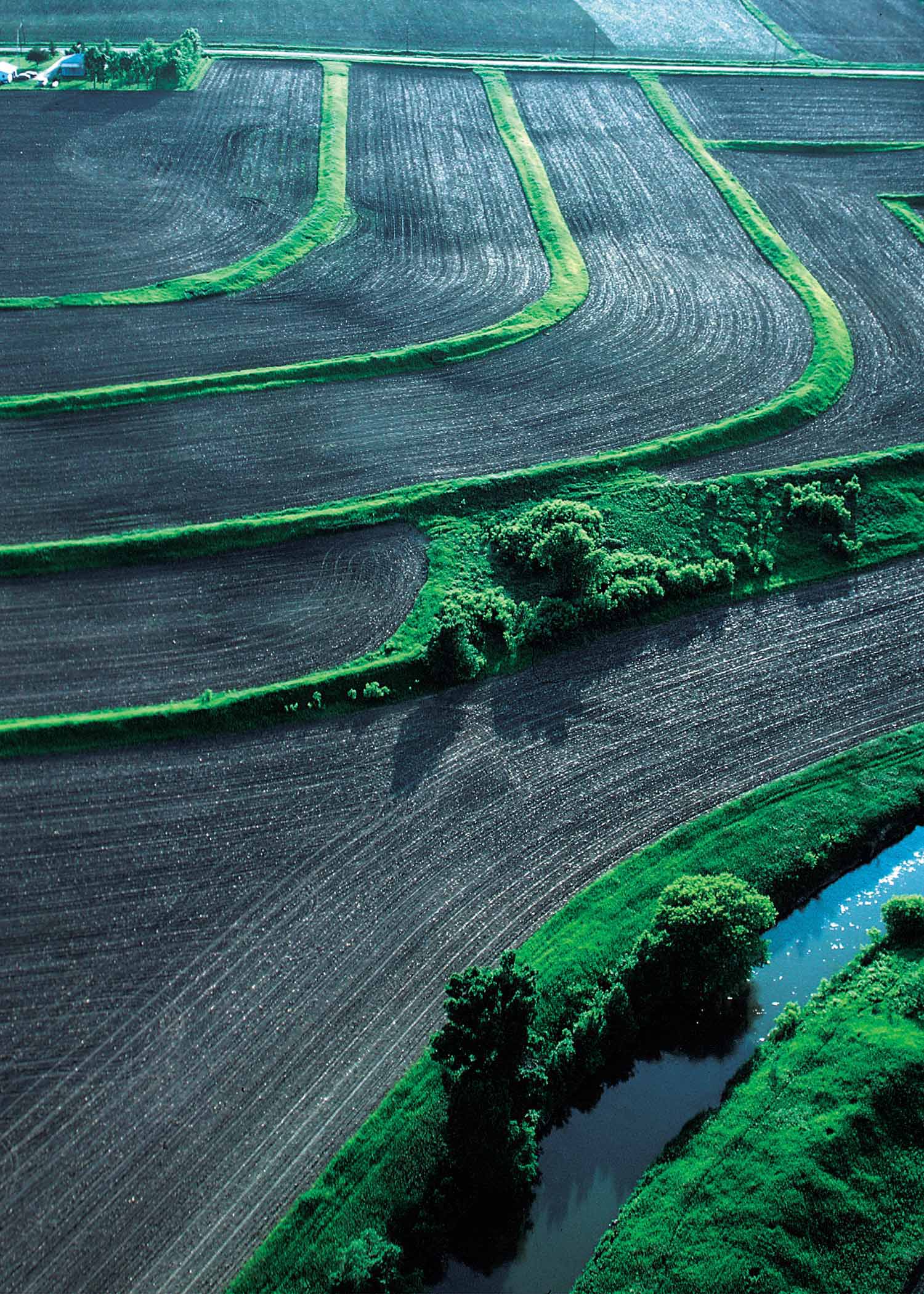
| Terracing | Terracing involves cutting flat steps into a sloped hillside. This structural change slows down water runoff on sloped hillsides. Because the water slows down, it loses its carrying capacity, meaning terracing reduces soil erosion on sloped hillsides. | Hydrosphere (Water runoff) |
| Breakwaters | Breakwaters are offshore coastal structures designed to intercept waves before they hit the beach. By absorbing the wave's kinetic energy, breakwaters protect coastal land from wave erosion. | Hydrosphere (Ocean waves) |
| Windbreaks | Windbreaks are linear plantings of trees or shrubs along the edge of a field. Windbreaks reduce wind speed over open land. By disrupting the airflow, windbreaks prevent topsoil erosion. | Atmosphere (Wind) |
Understanding that a massive ice sheet carved a valley millions of years ago is an abstract, difficult concept for an elementary student. Physical models help students visualize Earth system interactions that are too large to observe directly (like an entire river basin) and help students visualize Earth system interactions that occur too slowly to observe directly (like a canyon forming over millennia).
The premier tool for this in the elementary classroom is the stream table. Stream tables are physical models frequently used in classrooms to demonstrate the processes of water erosion. They typically consist of a tilted tray filled with sand or a sand-clay mix, with a water source trickling from the top.
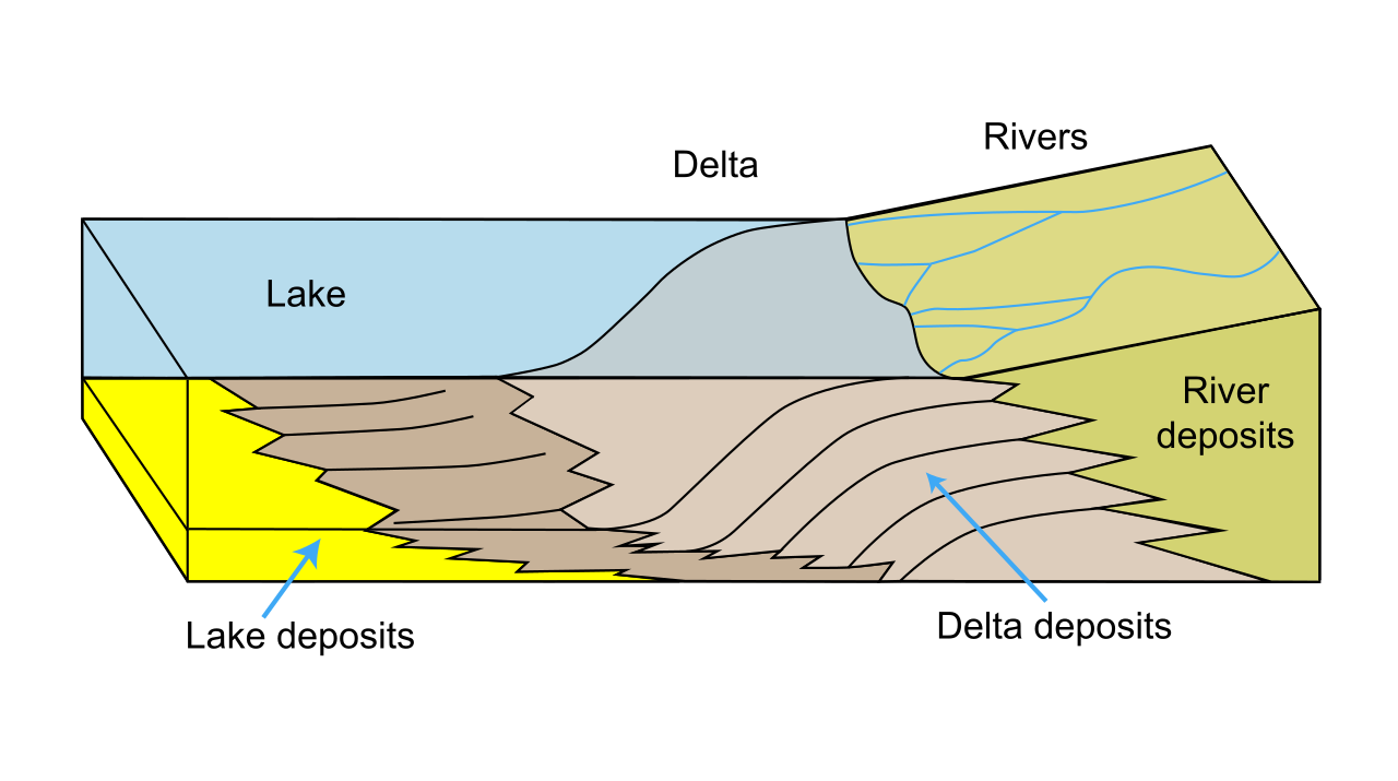
By manipulating a stream table, students can watch a micro-river carve a channel (erosion) and watch the sand pile up at the bottom of the tray in a delta. Therefore, stream tables are also physical models frequently used in classrooms to demonstrate the processes of sediment deposition. By changing the slope of the tray or the flow of the water, students can witness in ten minutes what takes the planet ten thousand years to achieve: faster water moving larger particles, the shifting shape of river banks, and the relentless interaction between the hydrosphere and the geosphere.
Through careful modeling, precise vocabulary, and constant connections to the students' observable world, you transform Earth science from a memorization exercise into a profound understanding of the living, breathing, grinding machine we call home.